

I really love finding truly remote roads. Quiet gravel tracks that trace a path to nowhere. There’s something special about finding a perfect camping spot as far away from civilization as possible, though I can’t fully explain why. Finding that perfect off-the-beaten-path road is harder than it sounds. They typically aren’t well documented and just because google maps shows a road doesn’t always mean it’s still drivable. Sometimes the scenery is lacking, or there are no good spots to camp. It seems the more I push the envelope with my travels, the more I’m set up for potential disappointment; though it nearly always leads to good stories.
Generally speaking, there aren’t a lot of roads in the heart of Labrador. There are long stretches of highway with nothing branching off. However, there are a few longer side roads that branch off around Churchill Falls. So this chapter of explorations was in search of the feeling of a good wilderness road. It had its ups and downs, times of trial, times of wonder, and little bit of God’s guiding.
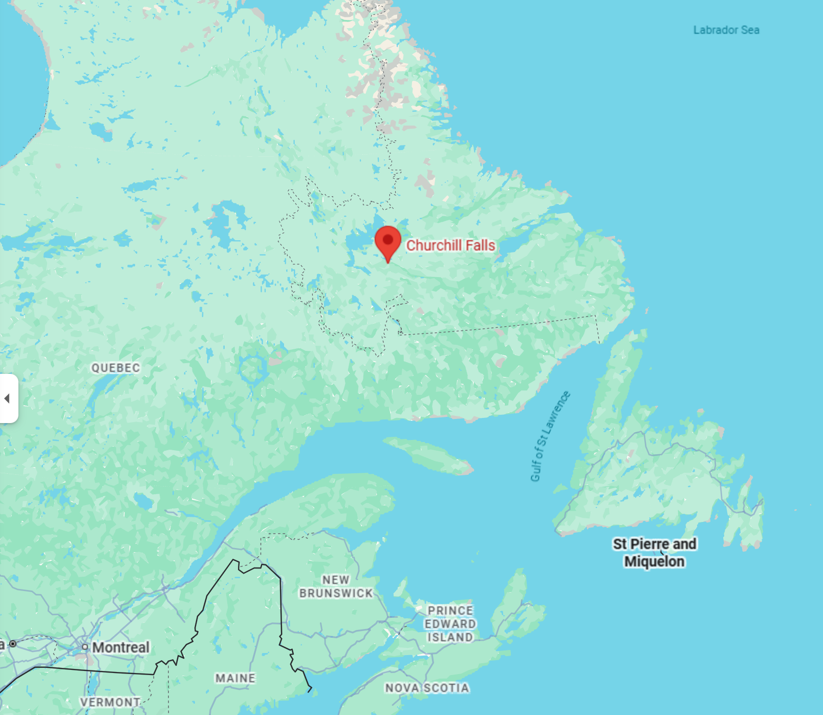
First up was getting gas in Churchill Falls. The town is quite small, a company town for the hydro workers, with small cookie-cutter houses, a grocery store and a gas station. There otherwise isn’t much here. In either direction it’s over 200km to the more substantial towns of Labrador City and Happy Valley-Goose Bay. Churchill Falls was the home base for these remote explorations and fittingly, it’s in the middle of nowhere itself.
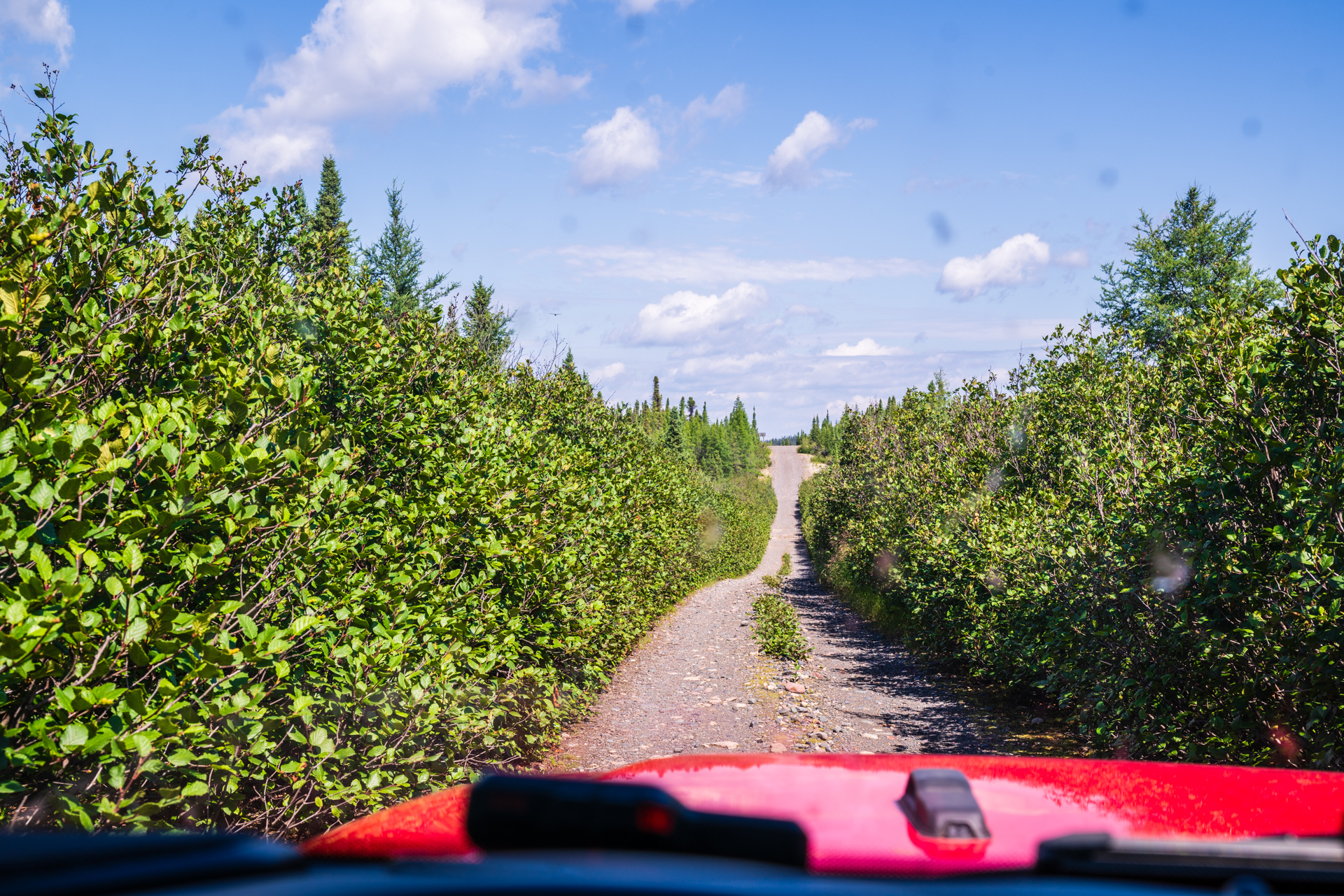
So I set out on Esker Road. It’s reasonably well known and there is some info about it online, but the information dries up about 9 years ago with mention of a washout partway down it.
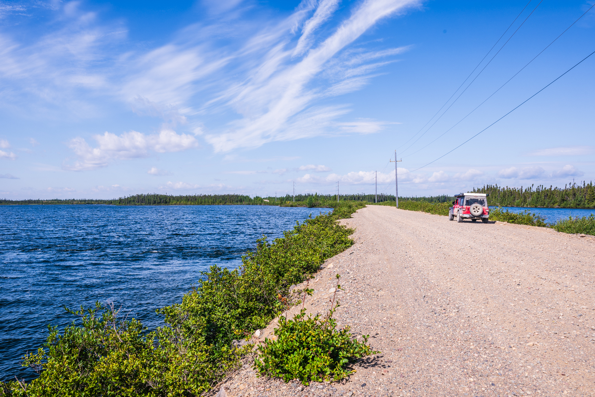
The first part of the road goes by a few embankment dams for the reservoir. It made for some nice views and there was a couple of spots where the road had water on both sides…which felt a bit weird on the somewhat narrow road.
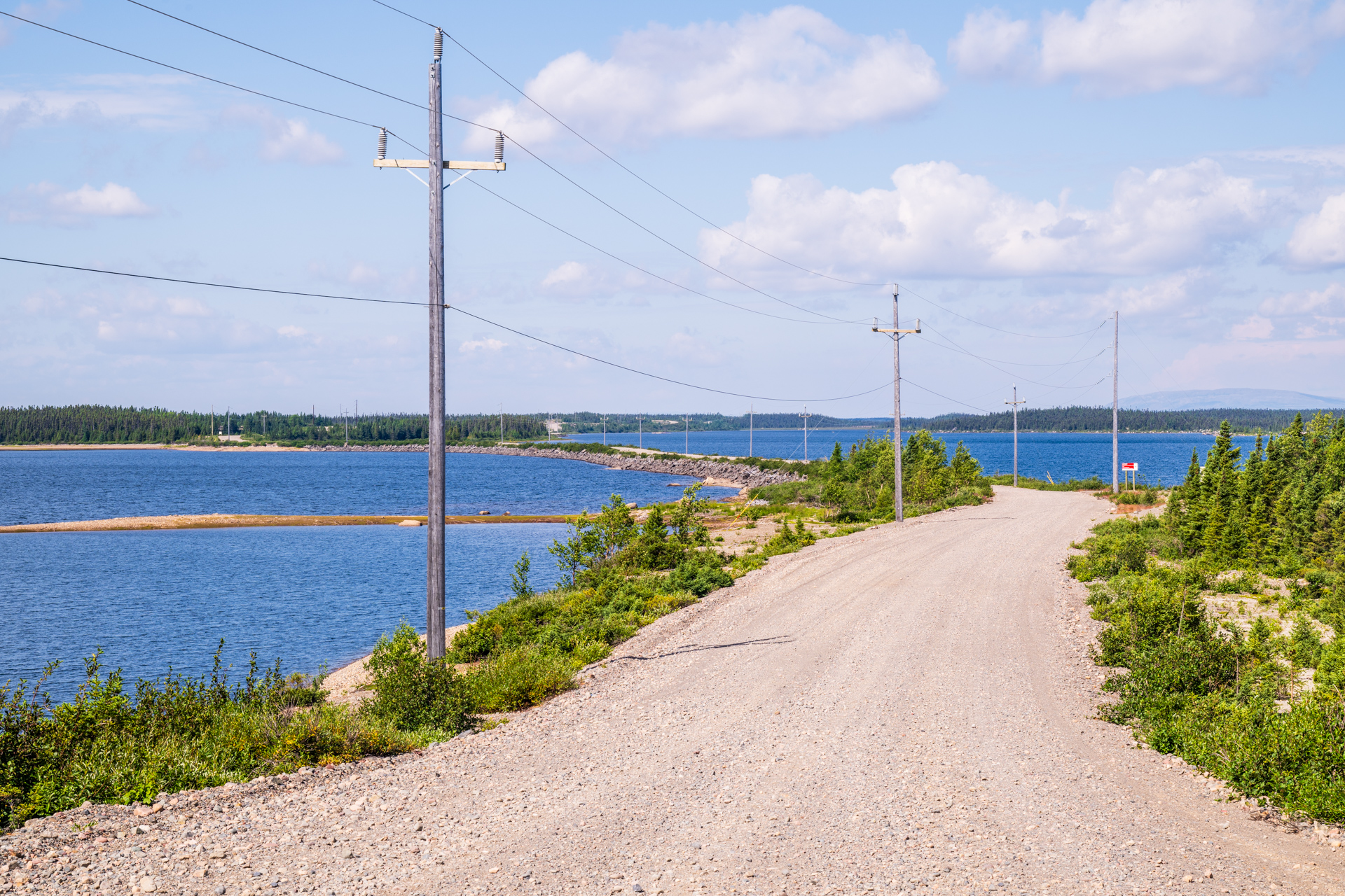
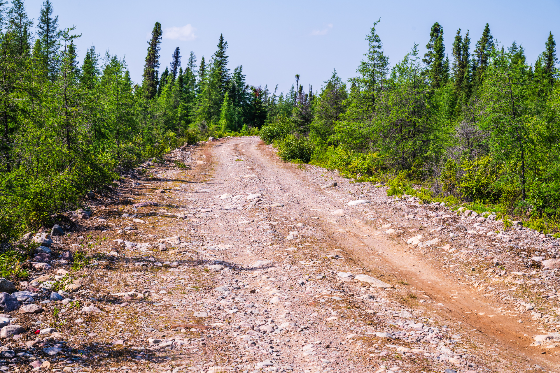
It didn’t quite have the remote feel that I expected, mostly because there were very civilized looking power lines along the road. It was also in very good condition and for the first part was just a normal gravel road, albeit with some nice views.
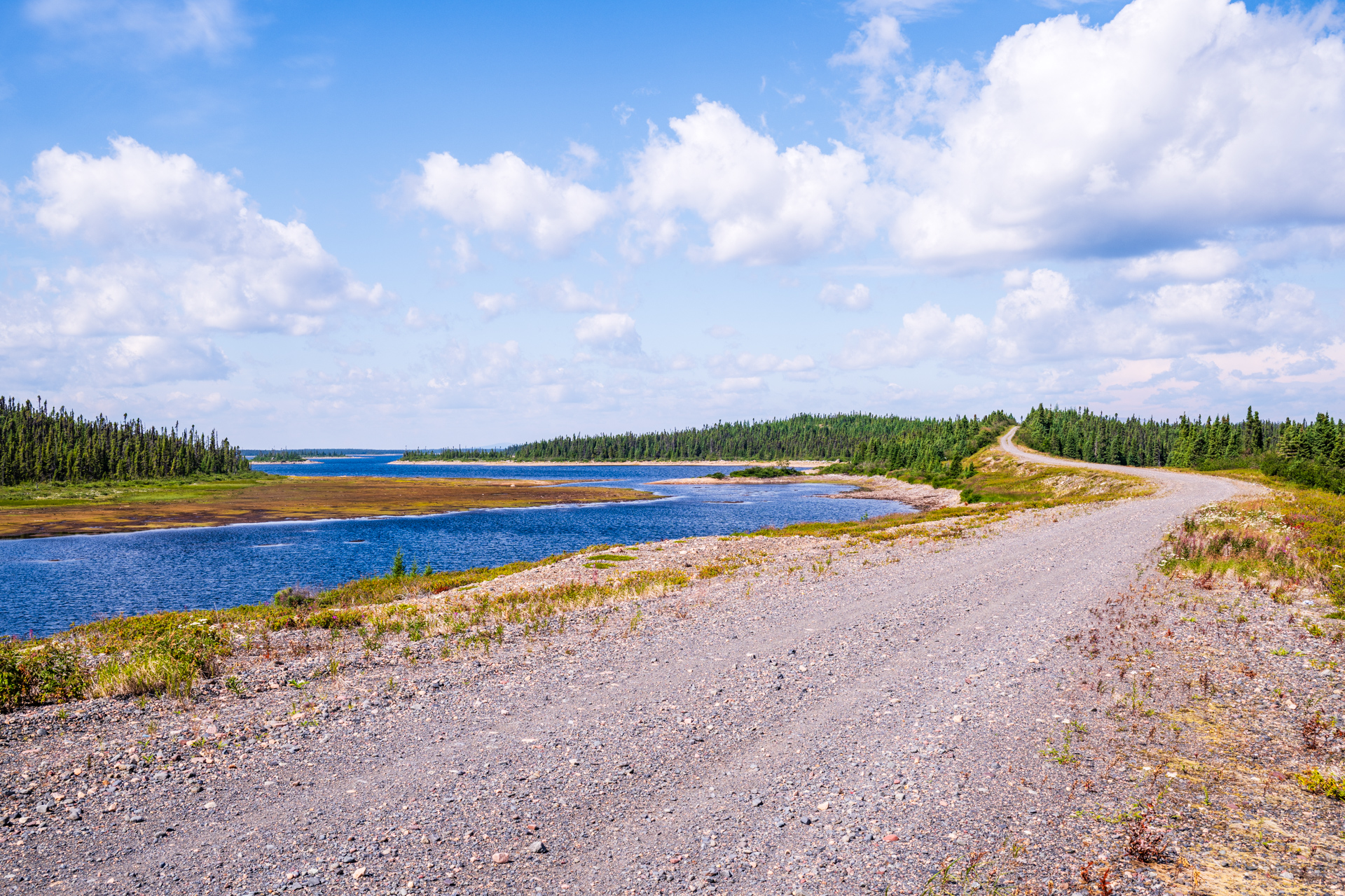
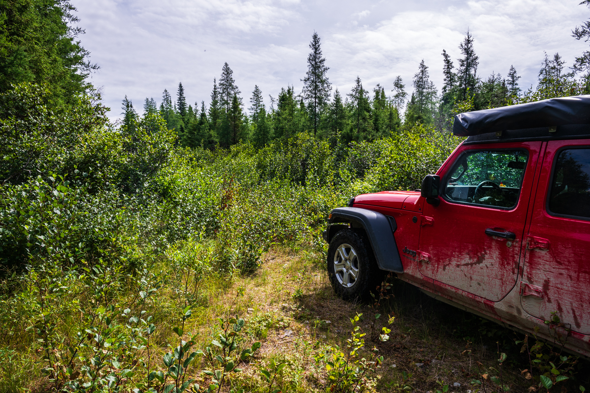
Eventually I reached a spillway structure, which was where the power lines ended. The road beyond immediately got rougher, which made sense, as there would likely be less traffic after the spillway. Things very quickly deteriorated and while it was still somewhat maintained, it was barely one lane, with branches scraping the sides of the Jeep. That slowed me down considerably. Without the reservoir, there were no more expansive views…just trees and bushes.
It was really slow going and there was still 80 km to go to the “end” of the road. I was beginning to question if it was worth the struggle, but didn’t want to give up and miss out, so I pressed on. Then there was a dead end, with a small bit of yellow tape in the bushes. Ah, the washout… There was a very narrow set of tracks that went around and crossed the water. It wasn’t very deep and I’m sure the Jeep could have handled it, but I knew the road would only be more overgrown past this point, so this was the end of the road for me. As it was, the last 20km had taken an hour to drive.

That night I camped by the water, near some cabins, not too far from the washout. It was a nice spot and I went for a walk along the road that evening. Not quite the ideal remoteness I was looking for, but still nice and quiet.

Next morning it was spitting rain. The next part of the plan was to move on to Orma Lake Road, but I didn’t want to explore it in bad weather. I also didn’t really want to stop for another rain day after the rainy time in Quebec just a few days earlier. So I set out back down the road, feeling quite unsure, not really having a plan at all…basically just figuring on finding a spot closer to the next road. The rain got worse as I set out, but eventually died down later in the day.
Near the beginning of Esker, there’s an unnamed road that turns off and follows the Lobstick Lake Reservoir(Lobstick Lake Road?). I had seen it on google maps when planning this trip, but decided it wasn’t worth my time as it seemed to have a lot of dam structures and thus wouldn’t have the remoteness I was looking for. Now that I was looking to waste some time in the rain, I decided to check it out.
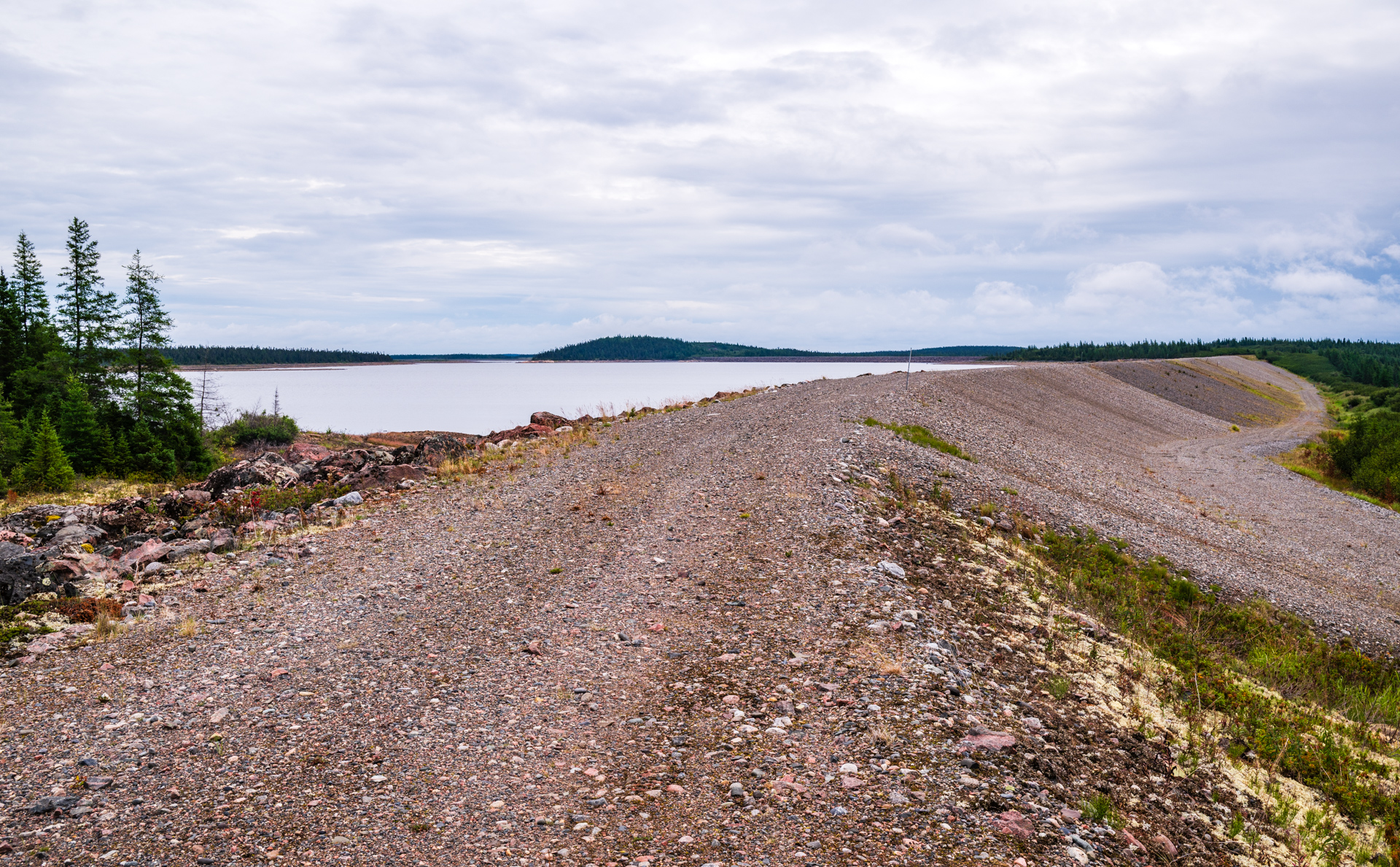
It was a bit of a different experience with lots of small rock embankment dams(dikes?), hemming in the edges of the reservoir.(plus another spillway) For each one, there was a road that went on the dam, as well as one below. At first it just felt wrong to drive on the dams themselves, but there were plenty of tracks suggesting that people did it, and no gates or signs to stop me…so eventually I did. Being on top was an interesting viewpoint and a little weird for some of the higher ones. (I later did see someone else driving on them, so I wasn’t the only one) I should mention, I hadn’t seen a single car or person on Esker road, and I saw a few on this road…for the first time in a little over 24 hours.
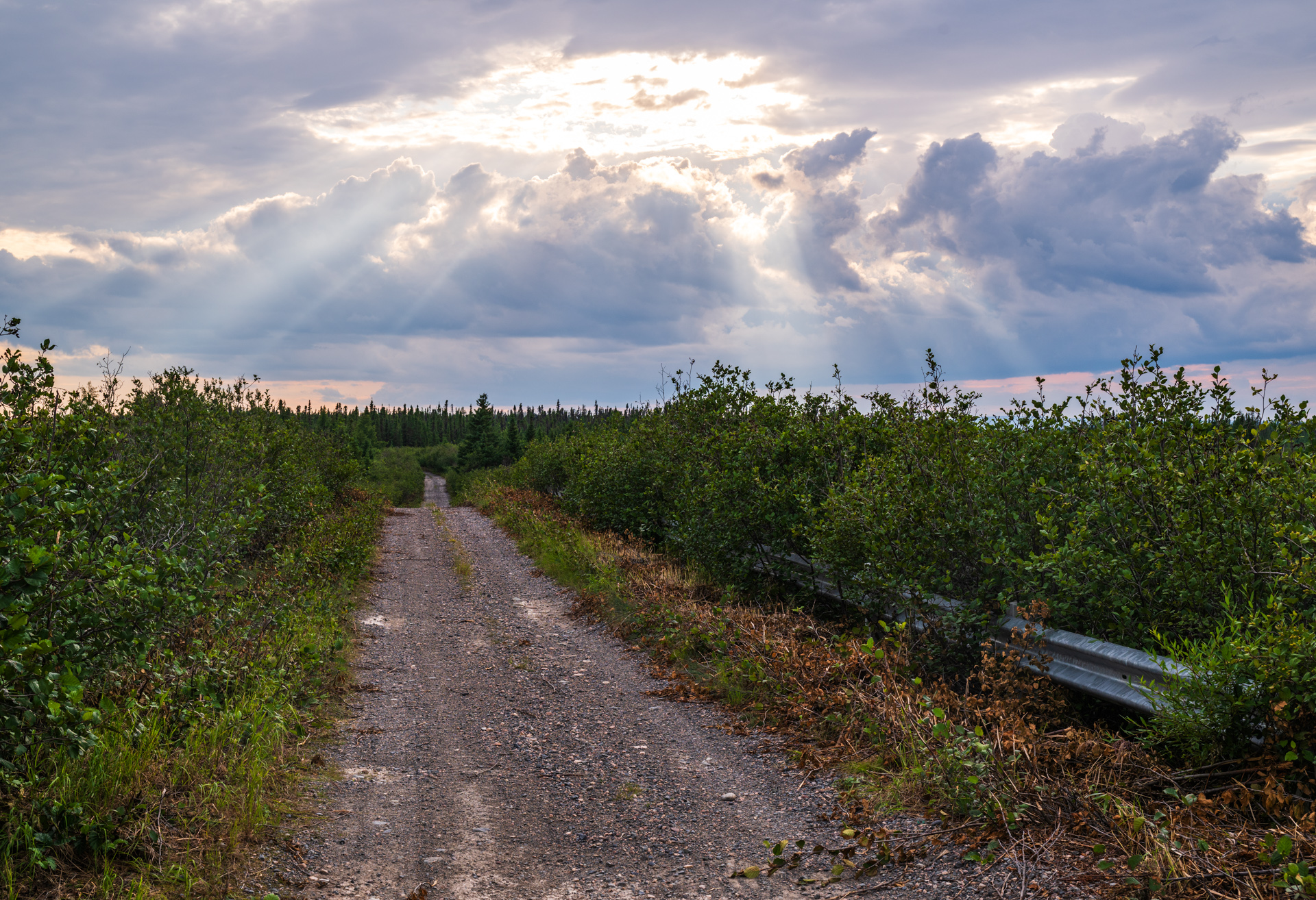
Getting closer to the end of the road it got really overgrown. On google maps it looks like there are still a few more dams beyond, but I guess not many people drive out that far. Eventually I was basically bulldozing small bushes and could hardly tell where the road was. I kept going until there was a tiny bit of space to turn around. Somehow, that ending felt more satisfying than the ending on Esker road.
I headed back toward the highway still hoping to find a nice spot to camp. It had stopped raining and the sky was beginning to clear. I found an old boat launch that was ok and setup camp…but there was no level ground and the area was kind of messy. It was still decently early in the afternoon, and for some reason I felt compelled to move on and find a different spot.
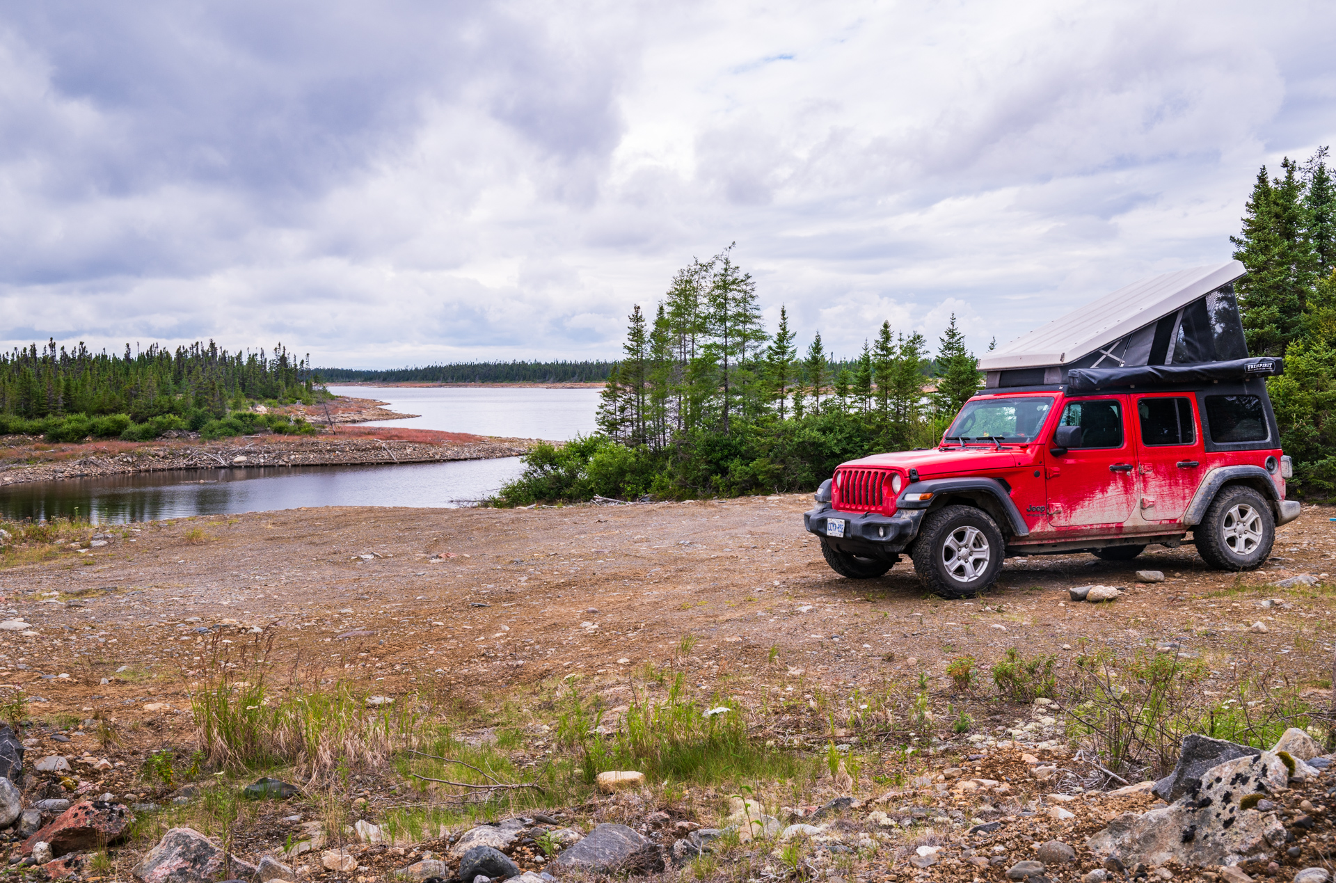
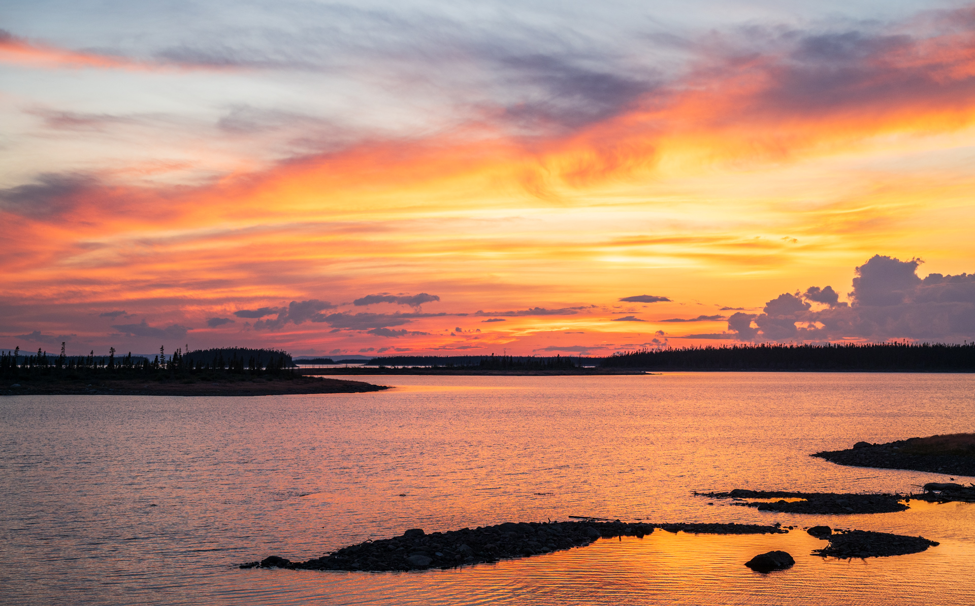
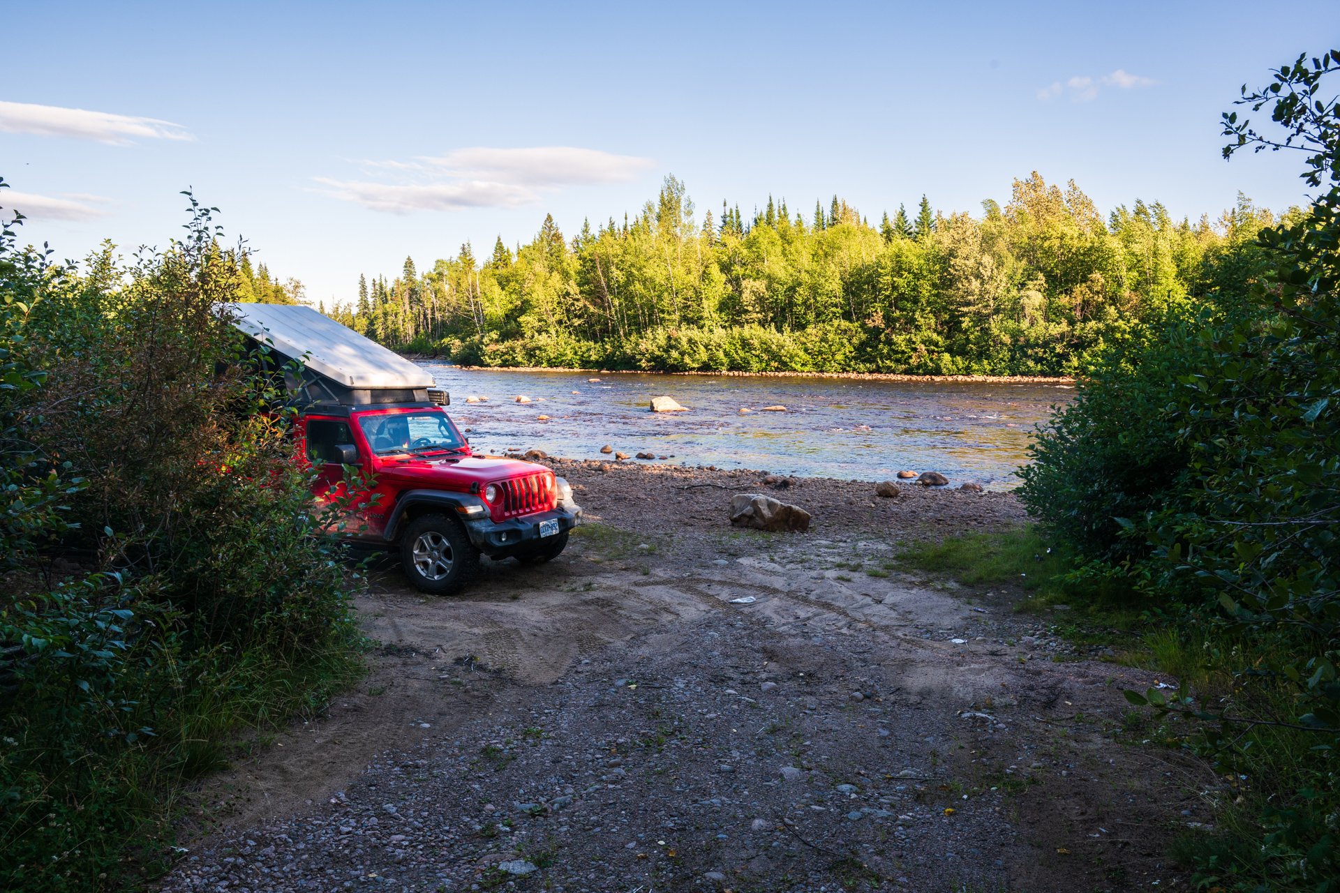
I turned down a random track and found a small dam at a dead end. Driving up the path onto the dam, I realized this would be a perfect spot to camp. And it was! This was the best inland spot I camped at! The bugs weren’t bad, it was quiet, and I had front row seats to the clearing storm and then the sunset.
For an unsure day with a bit of wandering and no plan it turned out amazing in the end. The interesting thing is: I wasn’t even planning to drive this road. A mixture of disappointment on Esker and the rain nudged me in this direction. Totally a little bit of God’s providence leading me to the best experiences!
The next day the sun was shining again! So it was back to Churchill Falls for gas, then onward to Orma Lake Road. I had high expectations and it mostly delivered…slowly. The beginning was quite well maintained and very straight, making it easy to fly along at a quick pace. It got rougher farther in, but mostly just from potholes and rocks poking through the road surface.

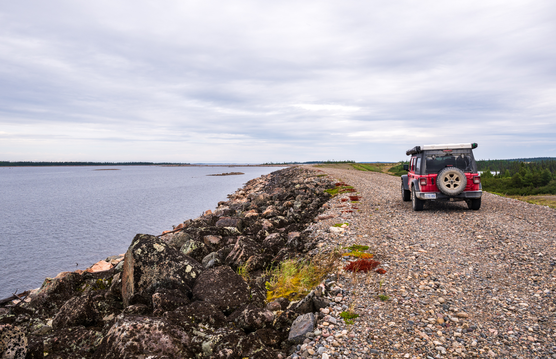
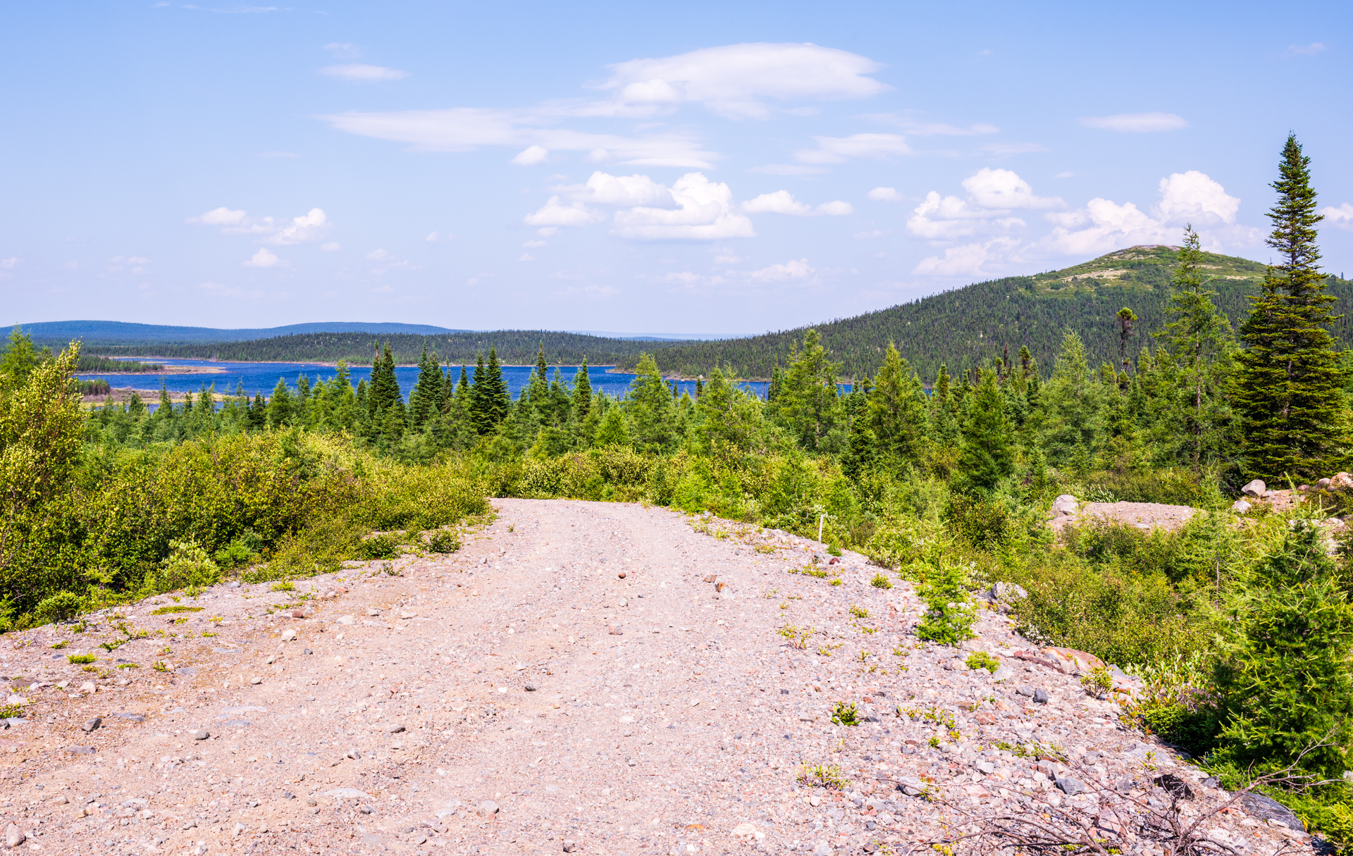
It was kind of different, as there were less places to stop, and I mostly just drove. It definitely felt more remote. There were less signs of civilization: no power lines and very few cabins. On Esker/Lobstick roads, the furthest I made it from the highway was 100 km. The northern terminus of Orma was 160 km from the highway. The second half of the road got a bit more hilly too with some nice scenic views. This was the kind of road I was looking for!

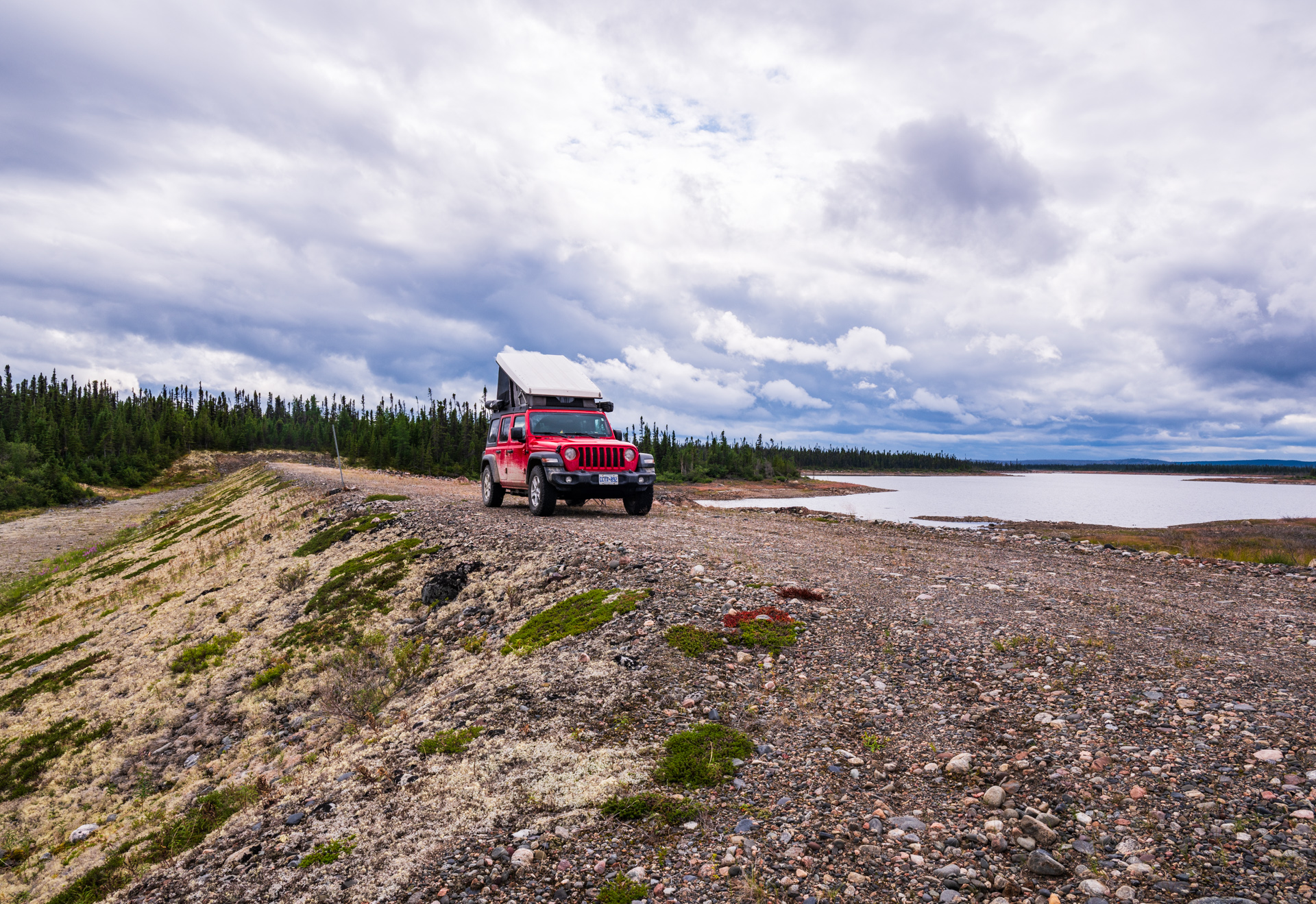
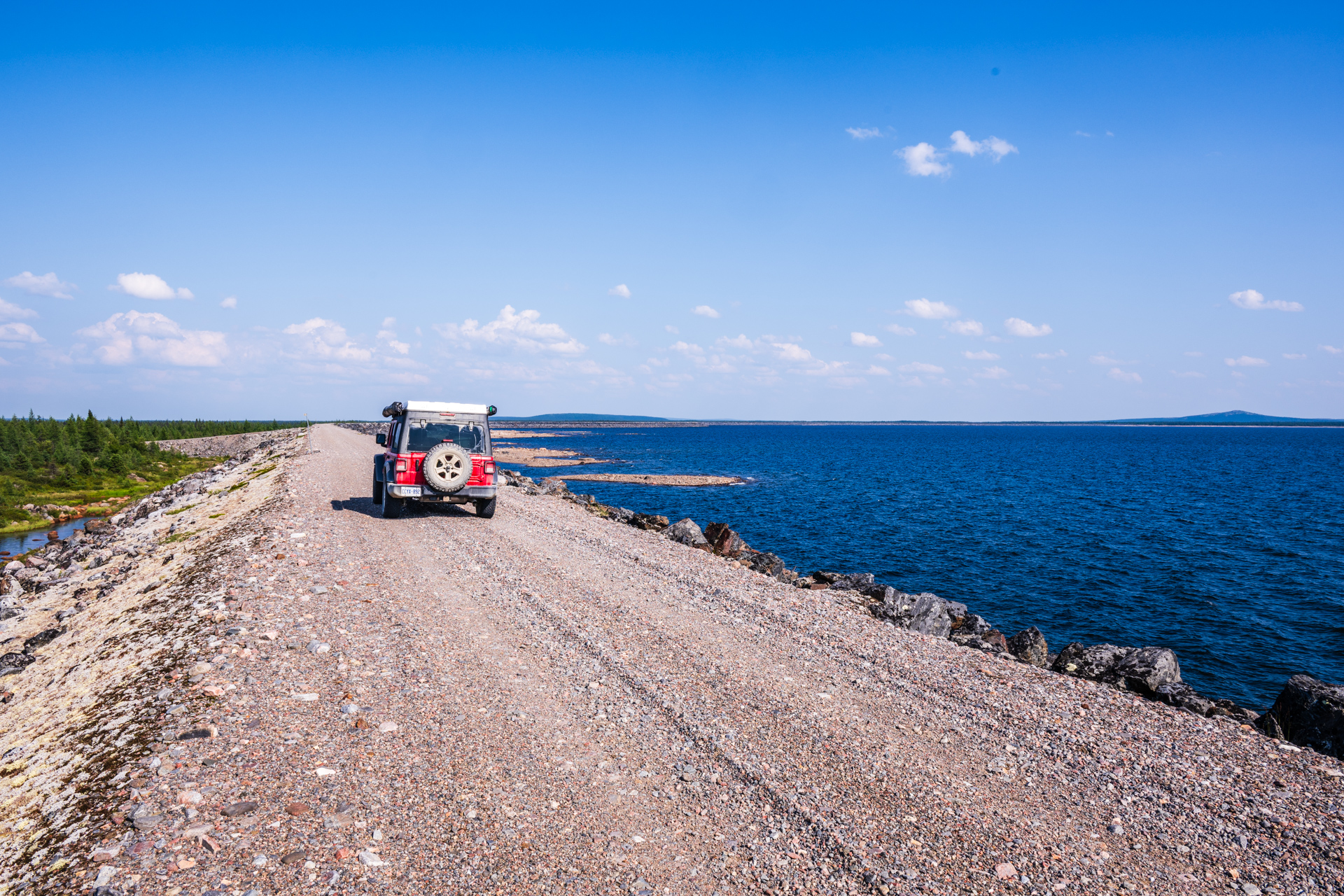
The end of the road had a long, curved dam holding in the corner of the lake. The actual end of the road was a bit unceremonious as there was a large steel culvert that looked like it had been pulled from under the road and left blocking it. Google maps shows the road would have ended soon anyway. I was able to get a little bit further by driving up on the dam to its end. Epic roads are all about the journey, not the destination!

I considered camping up on the dam again, but it was getting quite windy and this dam was higher and it felt a bit unnerving being up there with strong gusts of wind.
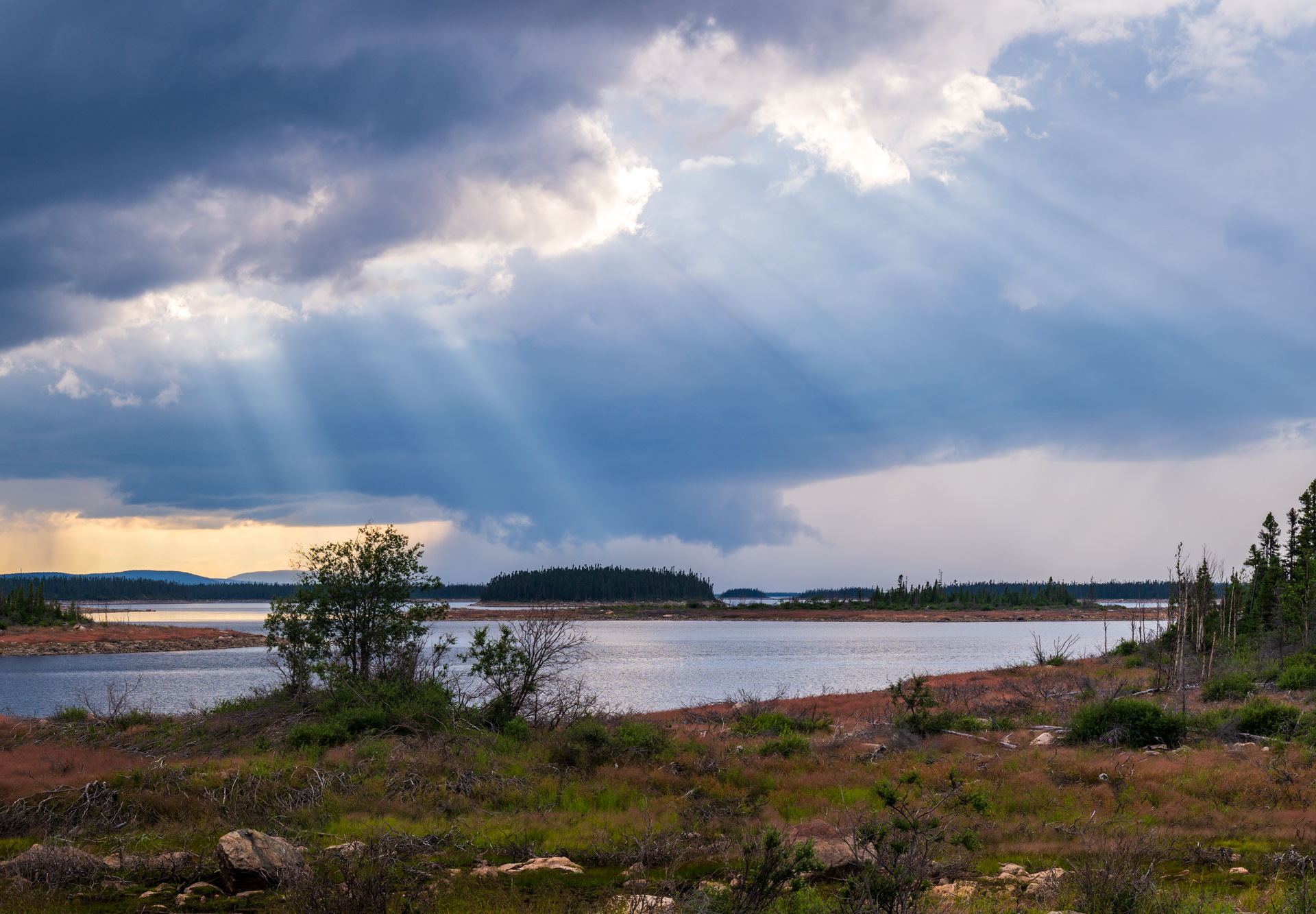
I hadn’t passed any nice spots to camp, so I ended up just below the dam, right beside the road…not like there was any traffic. The wind continued to pick up and got quite violent. It was windy enough, that sitting in my chair, back to the wind, I actually felt unstable, like the wind was almost enough to push me over…and that was with some shelter from the dam itself. I got up to take some photos and almost lost my chair as it blew away! I’m glad I didn’t actually stay up top!
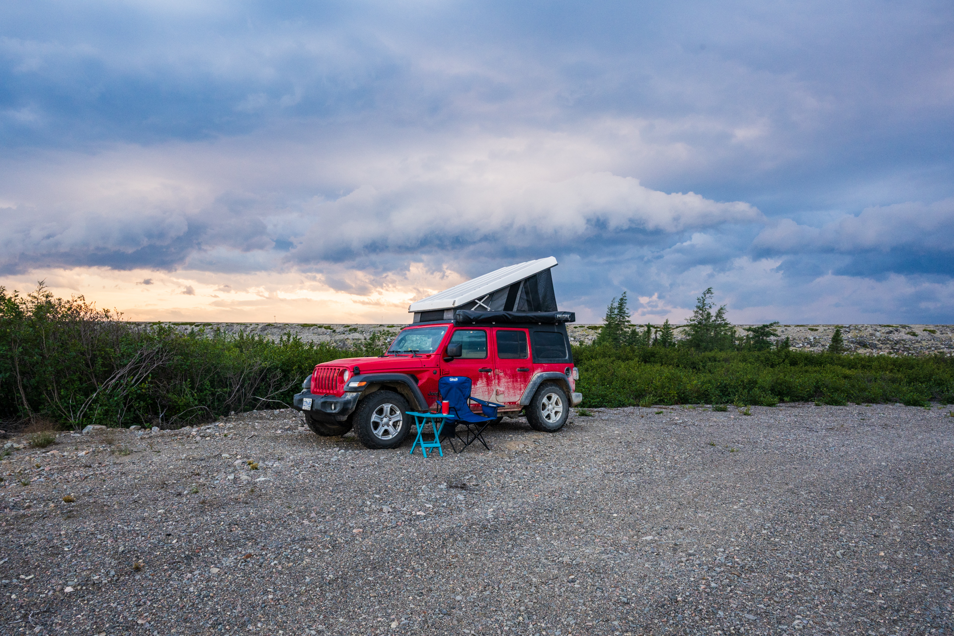
It didn’t rain much, although it looked like it might. The wild wind continued into the night. In a way, the weather added to the remoteness. A bit of harsh weather adds a very small sense of survival. There is something powerful about being engulfed in a storm, knowing there’s no civilization for a long way. (it helps when the Jeep camper is ok with bad weather…unlike a tent)

The next morning I set out on the journey back to Churchill Falls. I aired down my tires to get an extra bit of cushion, knowing that the rough last half of the road had slowed me down quite a bit on the way in. It did help, but it still took 4 hours to drive the 160 km back to the highway…and that was with me gritting my teeth, probably hitting potholes a bit harder than I should have.
I fueled up for the third time in Churchill Falls, they recognized me this time…then I was headed down the Trans-Lab to the coast. That night at camp, I discovered that the rough roads had shaken open my dish detergent, and there was a big soapy mess to cleanup…it’s a bit comical now, but it was seriously frustrating in the moment.
These wilderness drives have a tendency to be more trial than fun in the moment. The rough roads become a chore when it’s hours on end, and the lack of spectacular views can make me wonder why I do it. Yet, these remote adventures are nearly always the most storied part of my trips. There’s also a sense that the more effort something takes, the more satisfying the result.
It’s an amazing experience when I’m surprised on a trip. There is often enough planning that I know more or less what to expect. In the first part of the trip, with the early end of Esker Road, and then the unplanned drive down Lobstick Lake Road in the rain…I was gently guided to the best camp spot of this chapter. The unexpected trials are really an opportunity to go off-plan…to be led more directly by God’s hand of providence.

Beautiful pics Tim! Looks like another great adventure!
Hey Tim, in the “anonymous” comment lol. Wondering if you’re using a digital camera or your phone for pics – both? Dawn