

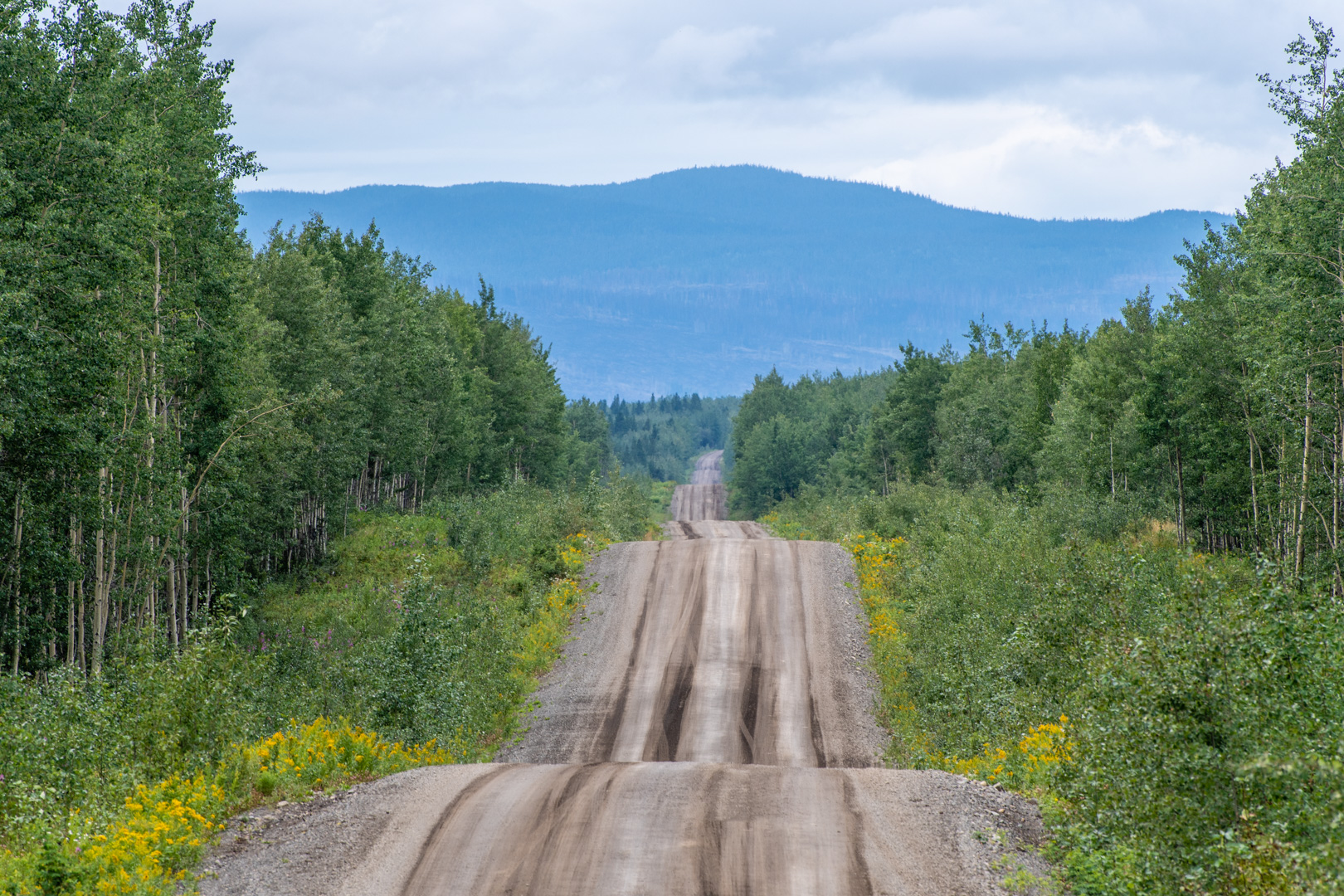
I finally returned to Telegraph Creek, or more specifically, the road to Telegraph Creek. Six years ago I called it the best gravel road I’d ever been on, and I think that title still stands. It’s 112 km of gravelly goodness, winding through the mountains toward the ghost town of Telegraph Creek. (there is also the proper town of Telegraph Creek, which is home to the Taltan Indians)
After all my rain days, the weather was finally kind of clear. I set out down the road. The first 60 km is just narrow twisty road through the bush. It’s more dirt than gravel. I remember it being a rough experience in my car 6 years ago, but in the Jeep it was so much fun.

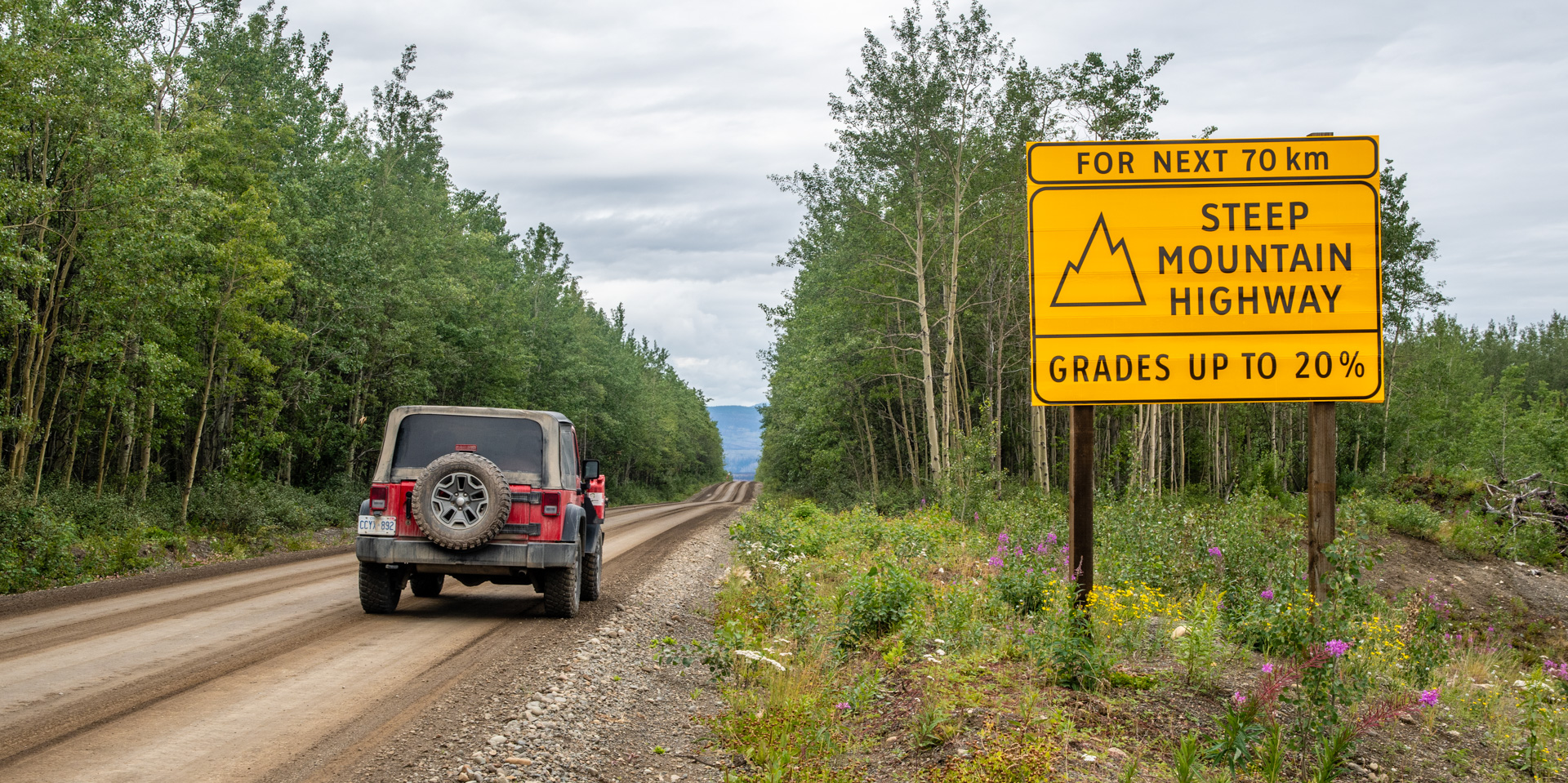
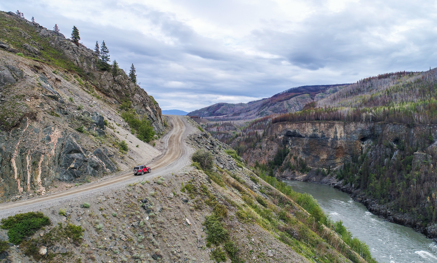
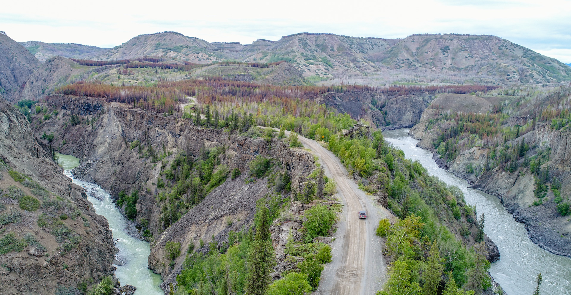
Then it starts winding down into the valley. It all starts with what is probably one of the best road signs ever. The hills become crazy steep, with cliffs on the side and a long way down. The views are incredible as the road becomes one with the landscape in a way that few roads ever do.
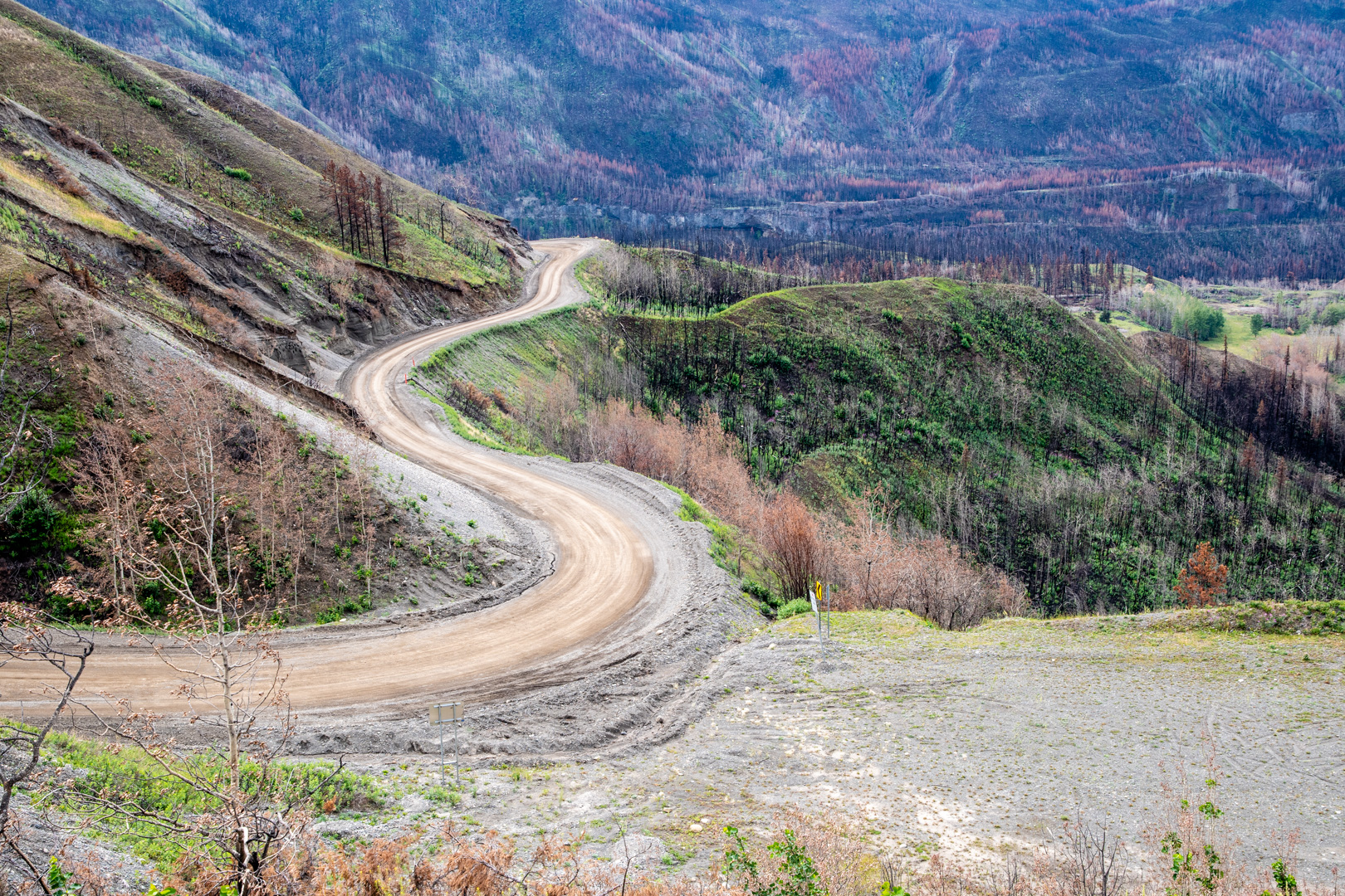


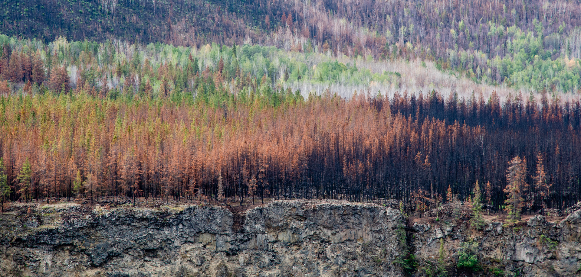
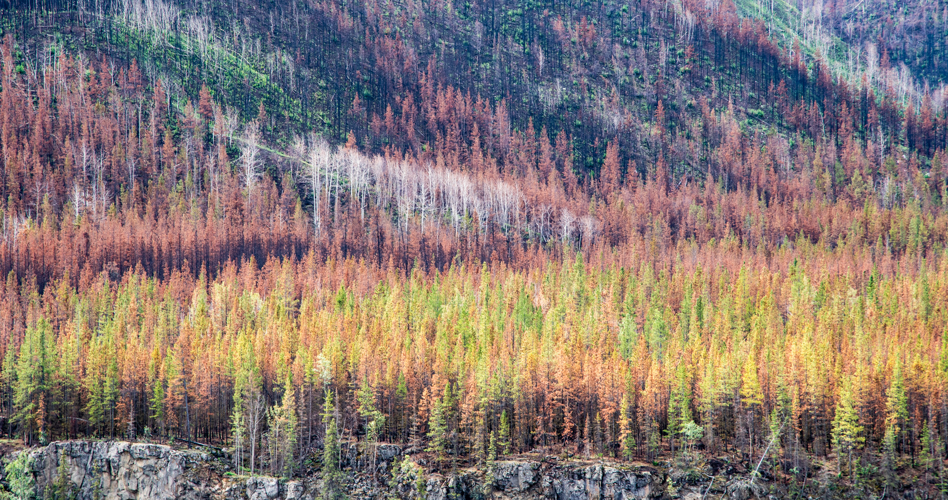
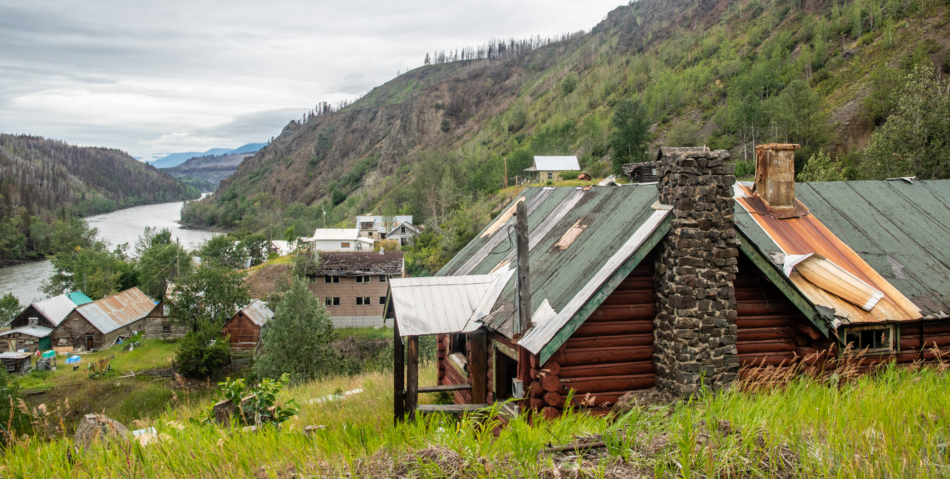
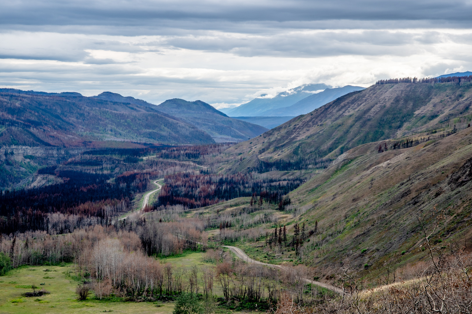
There was a major forest fire here last year. The Alkali Lake fire. The town was evacuated and a number of buildings were destroyed. The ghost town portion survived, although I could see that the hill directly across the river would have been completely engulfed in flames. So the road has changed since last I drove it. There was a lot of burnt areas as well as areas where it looked like they had knocked down swaths of trees next to the road to keep the fire from jumping. There is a certain beauty to the burnt areas, especially on the edge. There trees that had not completely burned, but had been killed, and their needles had turned orange. I’m really not sure if there’s something deeper to be seen in this, but it certainly made the scene a lot better looking than if everything was just black.
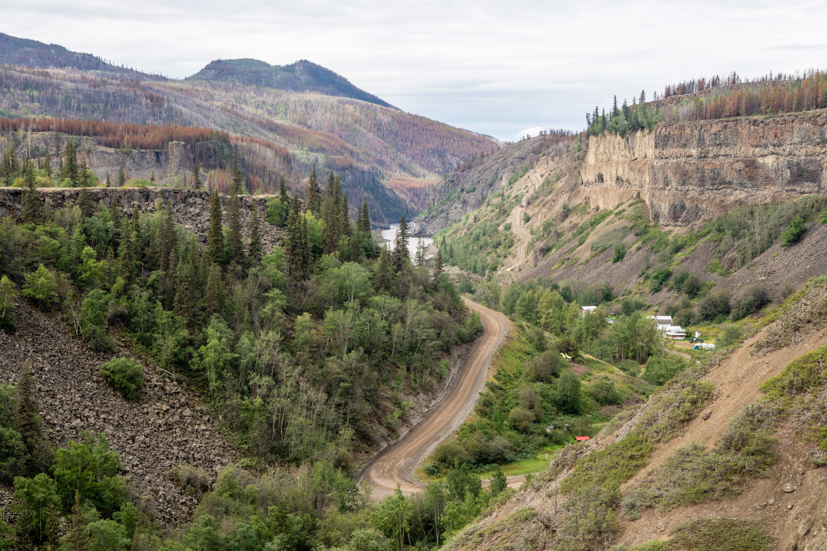
As I arrived at the road down to the ghost town, and there were signs up saying there was a washout and the road was closed. It looked fine, and there were some workmen standing around just down the road. So I drove down to them and asked if the road was passable. They said it was, so I kept going. The road winds through a narrow canyon with Telegraph Creek rushing down alongside. It looked like a long portion of the road had been washed away and they had just finished fixing it. I heard that it apparently happened only a week ago. I wonder, if I hadn’t had all those rain days, I might not have been able to drive down here. God may have deeper plans in my disappointing rain days.
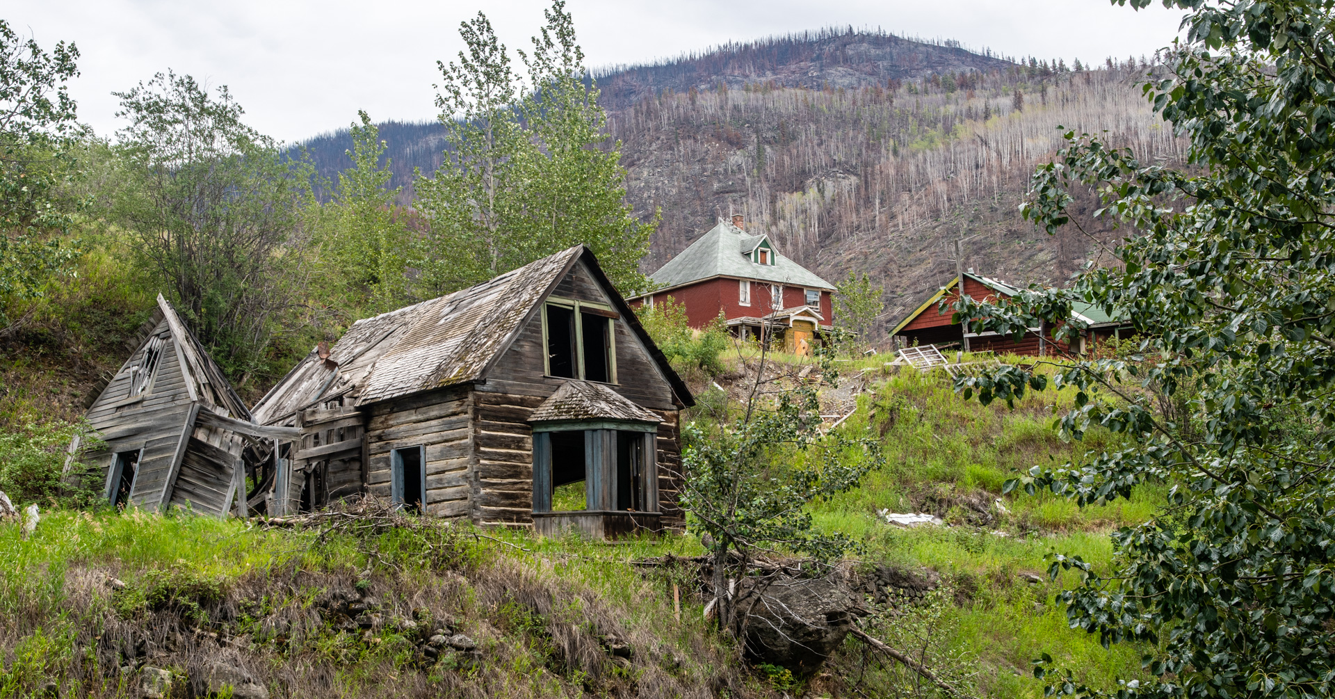
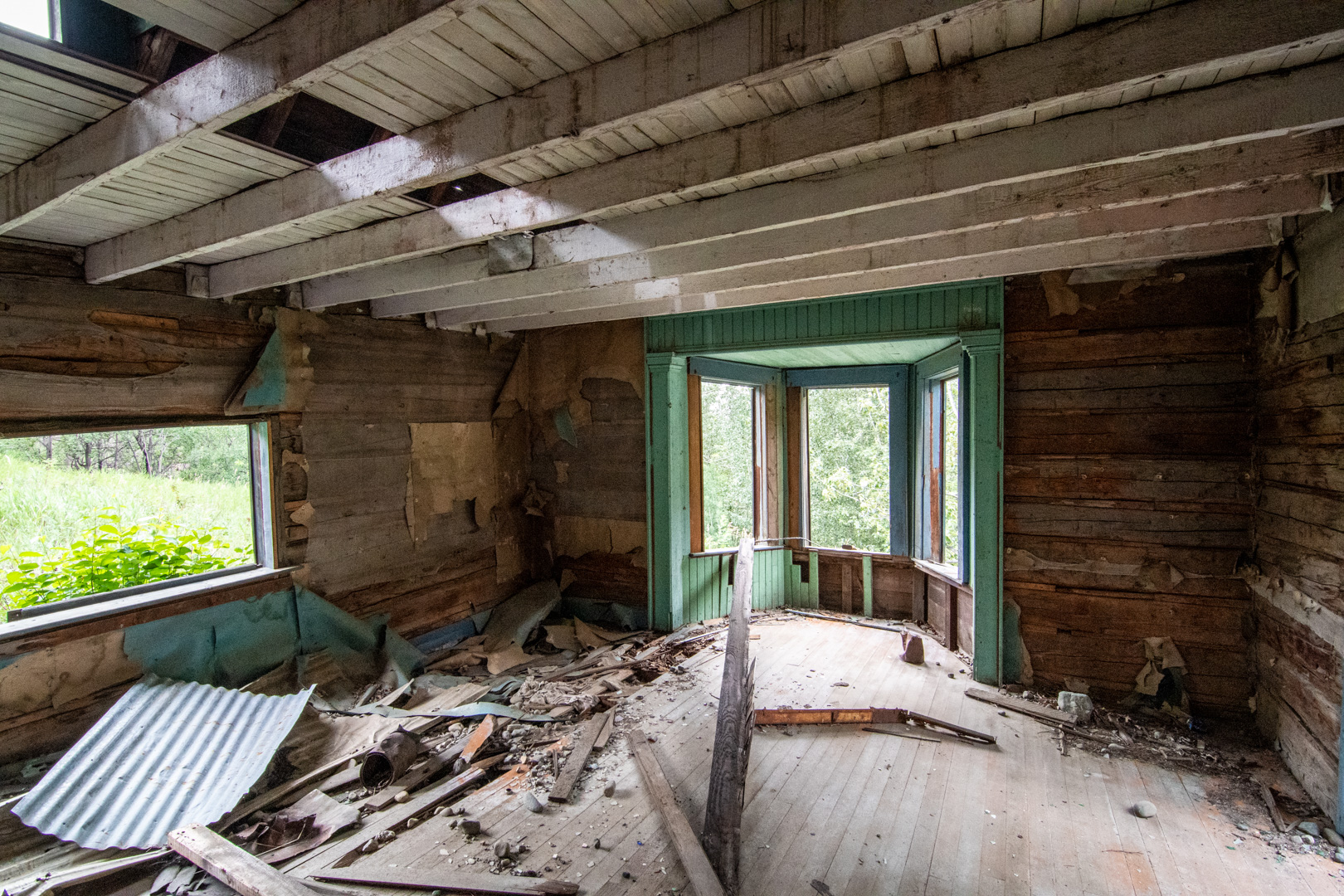
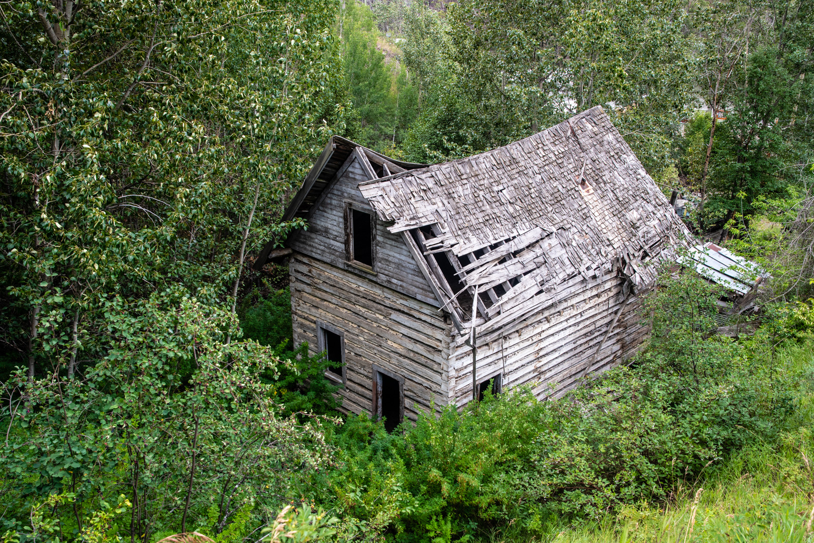
The ghost town is kind of fun as there are a number of abandoned buildings, some of which are wide open and you can go inside. It was really surprising that in the past 6 years, it doesn’t look like anything has changed. I’m not sure how that’s possible, as some of the buildings I would have expected to be more fallen over, especially with nothing keeping the elements out.


I drove back late that afternoon, satisfied with the days adventures.
Oh, and I did manage to get the drone out, and I took a couple of pictures that better show the road. I got some video footage too, but that will have to wait for another time.
The next day the weather was great and continued heading north up the Cassiar Highway. And then of course I had a day of rain…including a thunderstorm. Coming up next Yukon!


Hope you don’t run into the 2 teens that are leaving behind a trail of murders from BC east to Winnipeg! Thanks for the gorgeous pictures and your wonderful comments about your days!! Yes, God uses our disappointments for His appointments!! Rom. 8:28 All things work together for good… PTL!!!
Be safe and continue to be blessed.
Tim, I’m enjoying catching up on your adventures from time to time. 2nd last picture shows Jeep riding a crest road between two significant rivers – separate water or a bridge over a river bend just past?
The two rivers join into one below the bottom of the picture. The road does a hairpin at the end of the ridge and goes down below were it crosses the river on the left.