

I love remote, off the beaten path roads. Especially the ones that are seldom driven. It excites the explorer in me.
Often times, the really remote roads don’t have great scenery. One of the things I’ve been looking forward to in Yukon is driving some truly epic, fully remote roads. The Canol Road is probably the best remote road that Yukon has to offer. More specifically, the North Canol.
Canol road is split into 2 parts. The South Canol is 230km and it runs from the Alaska Highway to the Campbell Highway. There are no services on it, and it is quite scenic…but it is a popular drive. As I’ve toured around Yukon, I’ve talked with a lot of people. Many of the locals know the South Canol and it’s on the list of many travellers.
Then there’s the North Canol. It stretches more than 200km to the NWT border…but doesn’t really go anywhere…when you get to the end, you have to turn around and drive back. And of course…no services. There aren’t many reports on the drive and I hadn’t run into any tourists who drove it or were planning to. Even most of the locals had never driven it. A few had, but it had been a long time. It has a reputation as a rough road, but it is one of Yukon’s numbered highways and is maintained.
I drove both South and North Canol. The truly epic journey was the North, so I’ll tell that story.
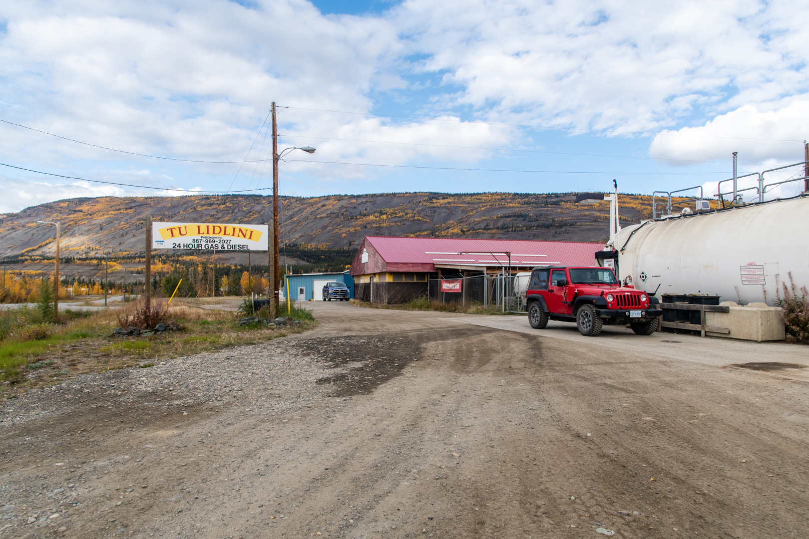
Every great remote road story starts at the gas station. Ross River is the last town and the last gas, and is basically the beginning of the North Canol. Of course the gas station was properly epic.

Then there’s the Pelly Barge. The smallest ferry I’ve been on yet. It had a wooden deck, wooden ramps, and that small black box next to the control hut is the engine that pulls the barge along the cable that is stretched across the river.
We haven’t even begun yet…so epic.
Oh, and of course right near the beginning of the road, I met a moose…with an absolutely epic beard.

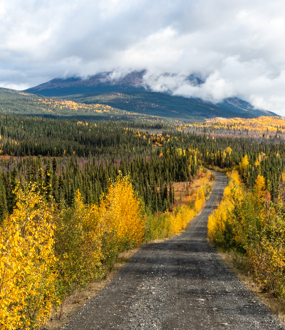
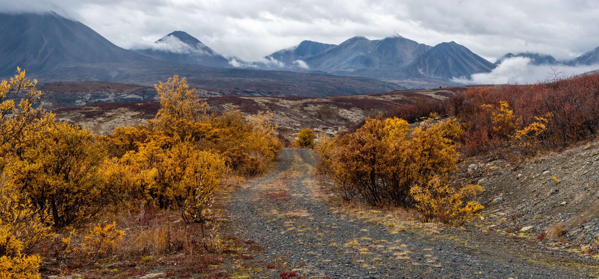
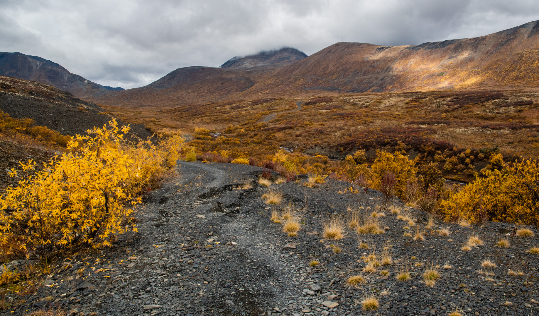
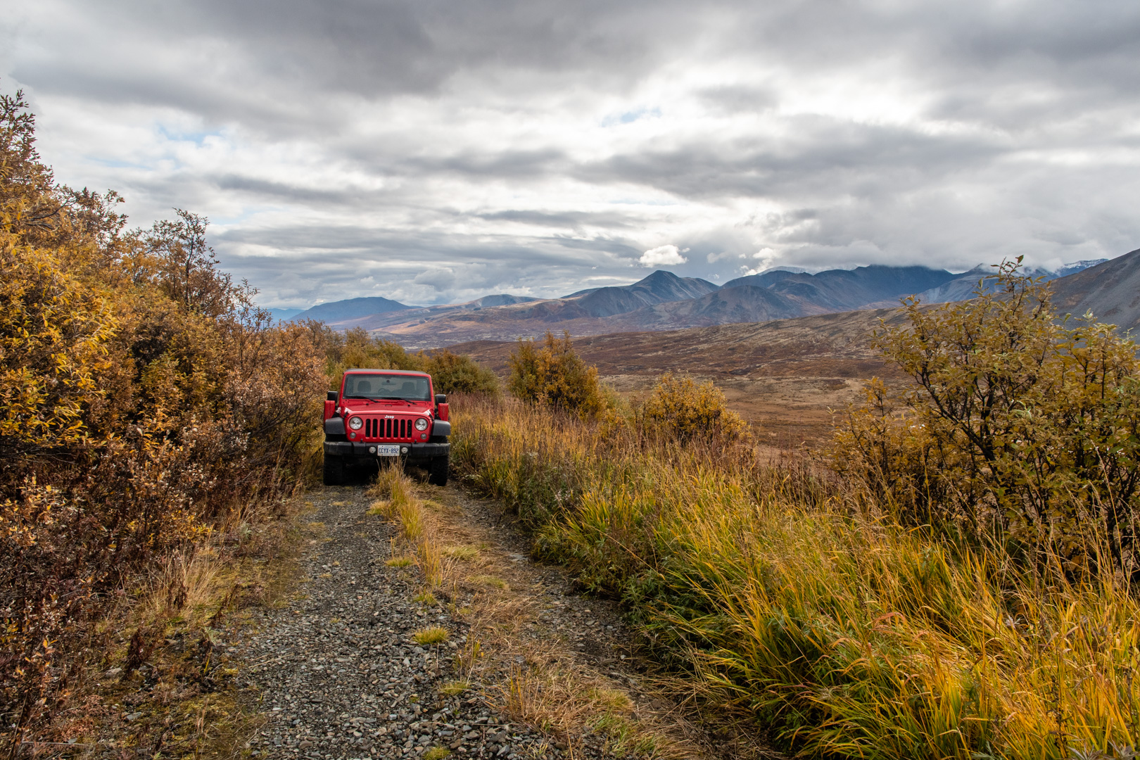
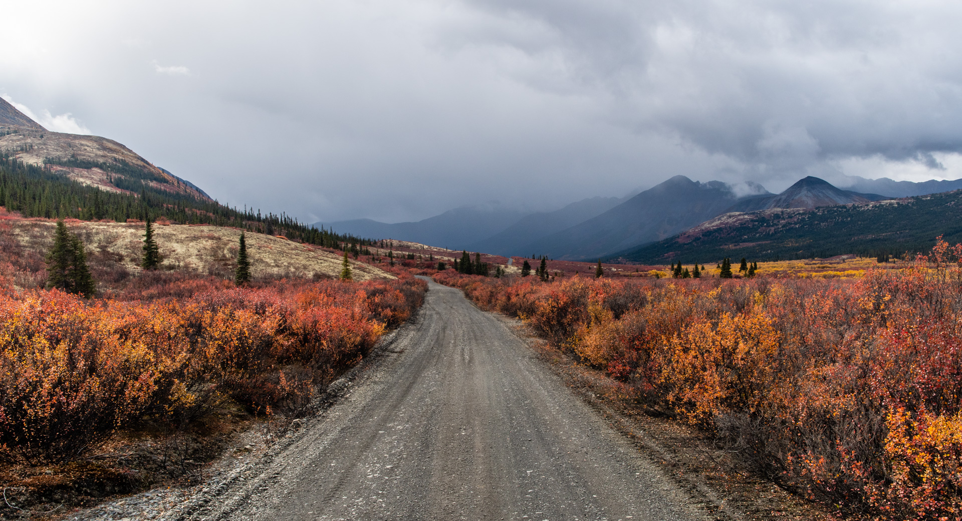
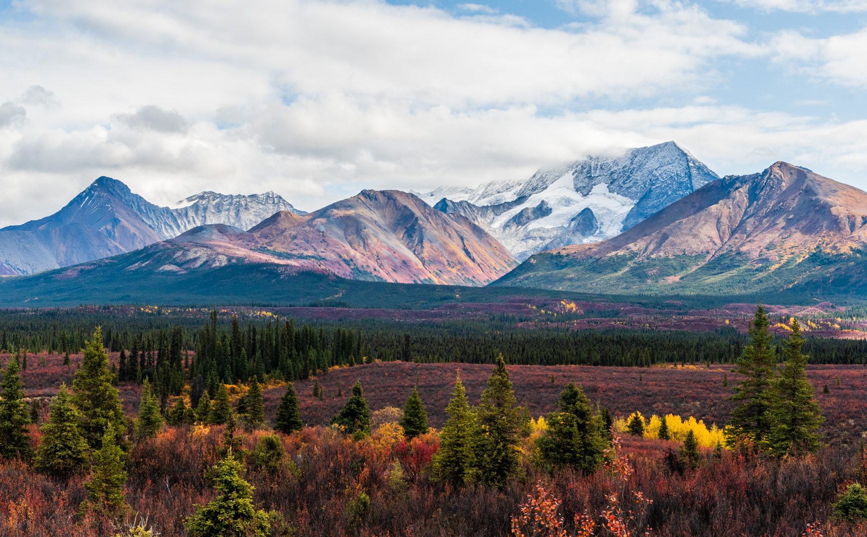
The fall colors were in full bloom, which for most of the road meant brilliant yellows. The first part of the road is kind of a build up for what’s to come. The colors were awesome, but the views were often few. It actually reminded me of old logging roads in Northern Ontario. Slowly the views gained size. But seriously, the first 130 km are long.


The road itself is quite rough. You can’t go fast. There are steep grades, tons of potholes, and even some semi washed out spots. This makes the journey all the more epic as you are forced to take it slow. It may have only been 240ish km, but it took multiple days. It’s also narrow, with lots of wooden decked, one lane bridges. There is other traffic, even if it is few and far between.
Every good road has a history. The Canol road’s story is as epic as it is. During WWII, along with the contruction of the Alaska Highway, the Americans needed to establish a supply of oil for their convoys. So they built a pipeline from Norman Wells in NWT, to Whitehorse. The Canol Road(CAnadianOiL) followed the pipeline. The pipeline was very expensive and was only used for a year before they scrapped it. The road fell into disuse and became impassable until the 70s. Yukon then fixed it up so it could be used for mining exploration. It still serves that purpose now. Here’s the most epic part. The Alaska Highway and Canol Road were the first real roads in Yukon. The Alaska Highway has had so many improvements that it is no longer anything like the original. Meanwhile, the Canol road is likely still very similar to the original. One might say it’s the oldest original road in Yukon!

There are several vehicle dumps along the way, where old trucks used in the making of the road are left to rust. They are missing quite a few parts as apparently people scavanged parts off of them in the early days. But how epic is it to have these old reminders of the actual vehicles that used to bump along these paths!


There are a number of bridges along the way. Most are short. The first bridge over the MacMillan River is quite a bit longer, and I think they must be stretching what is possible with this type of bridge, because there were signs up saying the maximum speed on the bridge was 5kph. At various points in the road’s history, bridges are usually what determine if the road is passable. This will come up later…

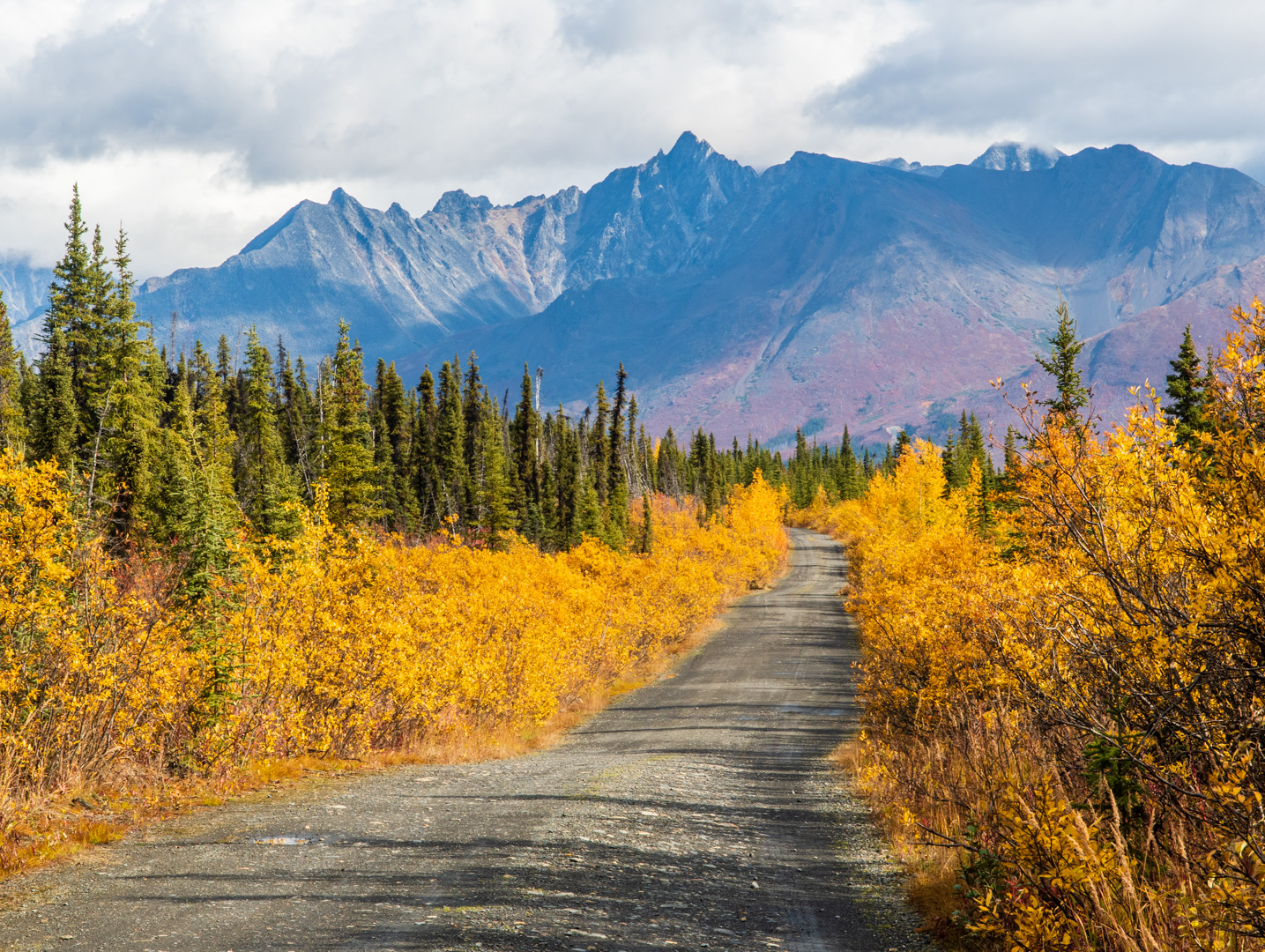
After a long drive, the road makes its way into the mountains. Suddenly, this isn’t just an epic road…it’s a spectacular drive!


There is a section of road that gets quite narrow here. Lots of potholes too…and when I drove it: semi-failing culverts…

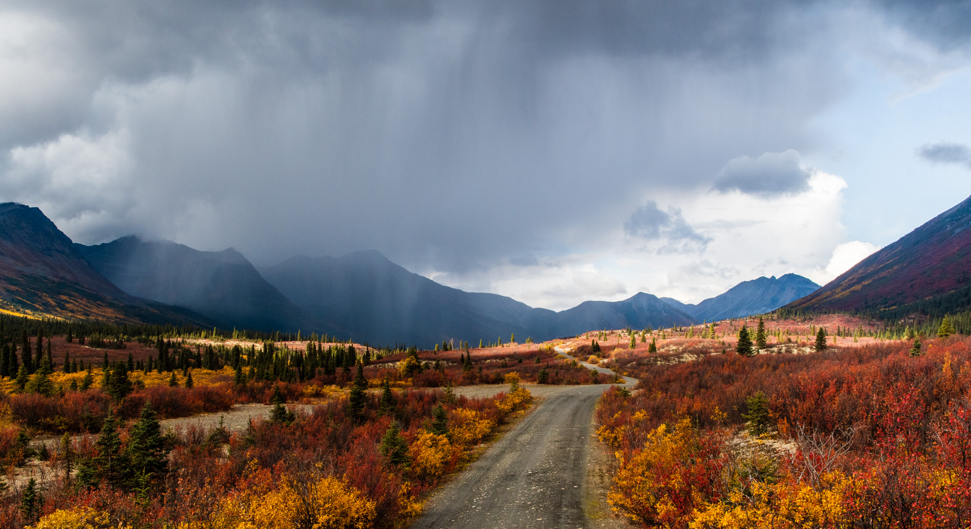
As the road reaches MacMillan Pass, it turns into the mountains and runs through the Macmillan river valley. Surrounded by close mountains. At this point I should mention that the weather was itself becoming epic. The sun was still shining through brightly, but there were isolated cells of torrential rains. I had to sit and wait by the side of the road for the rain to clear…several times. And it always did. But I could always see more clouds forming. There was some kind of weather system generating over the pass itself.

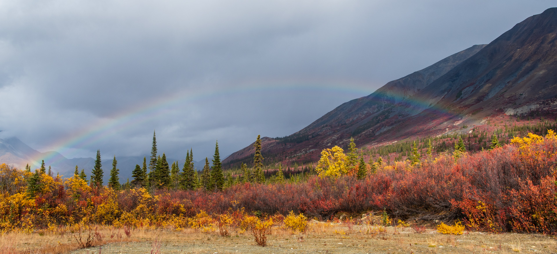
The conditions were perfect for rainbows! I saw several of them at various points. Including one that was so powerful…I don’t think I’ve ever seen one that thick!


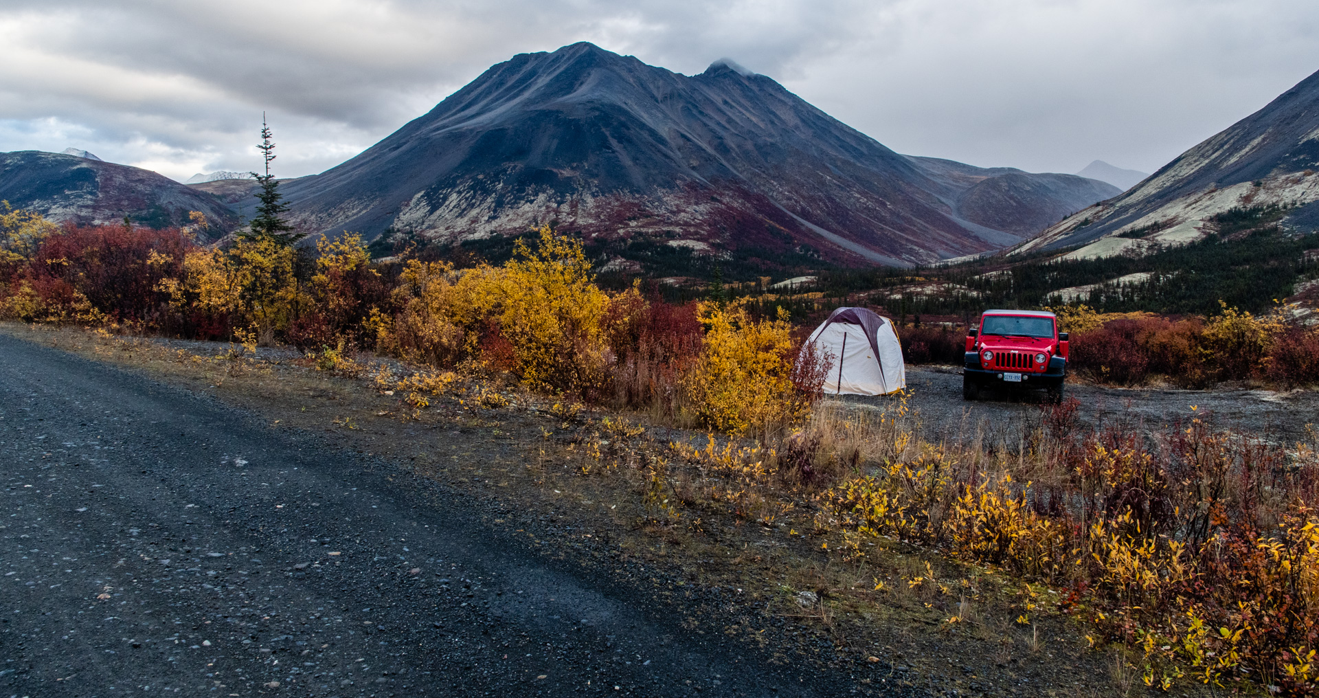
It was getting later in the day and I could see it was really dark up at the end of the pass. I saw a spot to setup camp, so I grabbed it. It was spitting rain, but it let up just long enough for me to build the tent. And then for a few moments I had a rainbow right over the tent! What a way for God to brighten a stormy time!
Oh, and by the way, I got an epic camping spot. 360 views of the mountains. It rained a bit, but did calm into a beautiful evening. Providentially, I had picked a spot between the competing weather systems, as most of the evening I could see rain on either side of me, but it didn’t hit me.
I should also mention, there were other people around. It is hunting season so there were a few hunters at camps nearby and I talked to a guy that worked in a mine nearby.
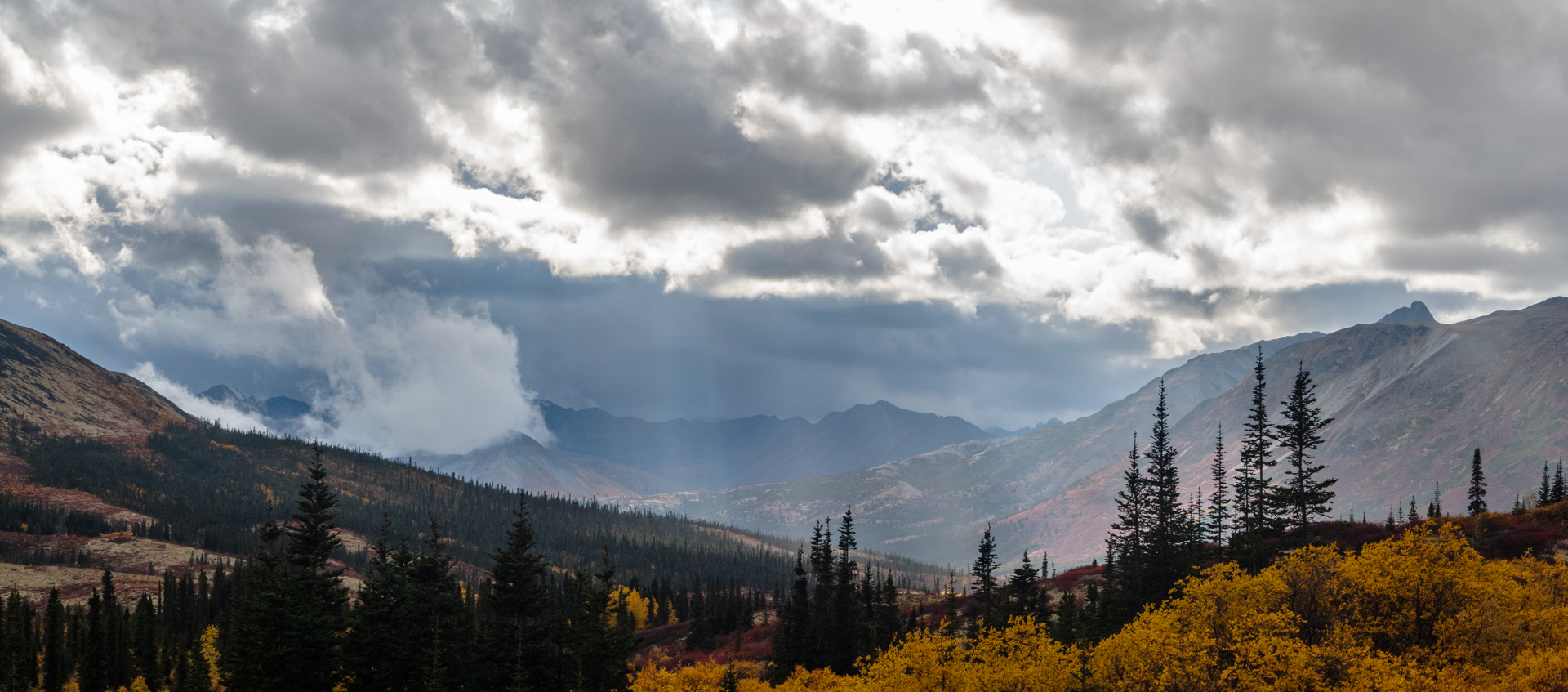
The next morning was foggy but calm. I enjoyed a slow morning at the campsite, then headed up the pass. I made it to the NWT border. The scenery switched gears a bit and looked completely different on the other side of the pass.


The road also got a lot rougher. Oh, I forgot to mention…while the original Canol road went to Norman Wells, when the road was fixed in the 70s, it was just the Yukon side. The NWT side was never fixed. At this point, it becomes known as a trail and while there are some people that still traverse it on foot, vehicles can only get so far.
Mostly because of this sign.

Ah yes. No services, no bridges… Wait. What?! Ok, I’ll admit, I knew this was how the road ended, but I’m think it’s great that they have to mention that on an official sign.
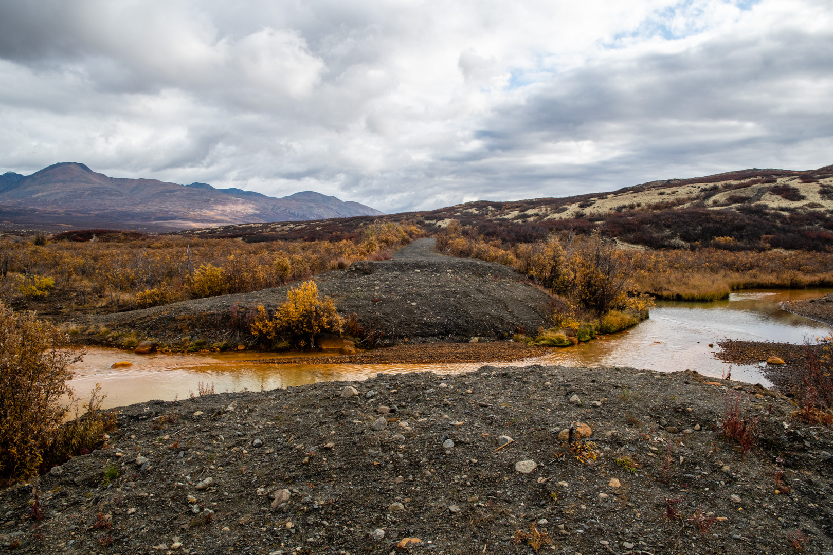
The first river crossing wasn’t far from the border. One of the locals I had met earlier thought I could probably make it across the first river(there’s a spot further down), but deep water crossings terrify me…so this was the end.

I’ll admit, the clouds were skimming the mountains and it just had that end of the road feel to it. But it just wasn’t what I was hoping for. As I turned around, I remembered seeing a turn off just past the border for the Mactung mine. It’s been closed for a while, and the road looked like not many people drive it. But it was smooth and looked like it might go somewhere interesting, so I headed out.
There was a small washout and a shallow creek crossing, but it was headed up to the mountain side. So here’s the thing. I know I’ve done some crazy off roads on this trip, but this far from help, my rule was: if it makes me nervous, I’m not doing it. So it was nice that the Mactung road really wasn’t that bad, but was quite epic.

I stopped at the spot in the above picture. I could have made it farther, but there was a steep incline ahead and this was actually a super epic place to call it quits. My end of the road. Turning around was fun…but with a short little jeep it works better than you might think.

I started the long, slow drive back. And of course once I reached the opening to the pass again, it was raining. I just kept on driving though. It didn’t last long. I enjoyed my last views of the majestic mountains. Experiencing them on a road like this just heightens the enjoyment!

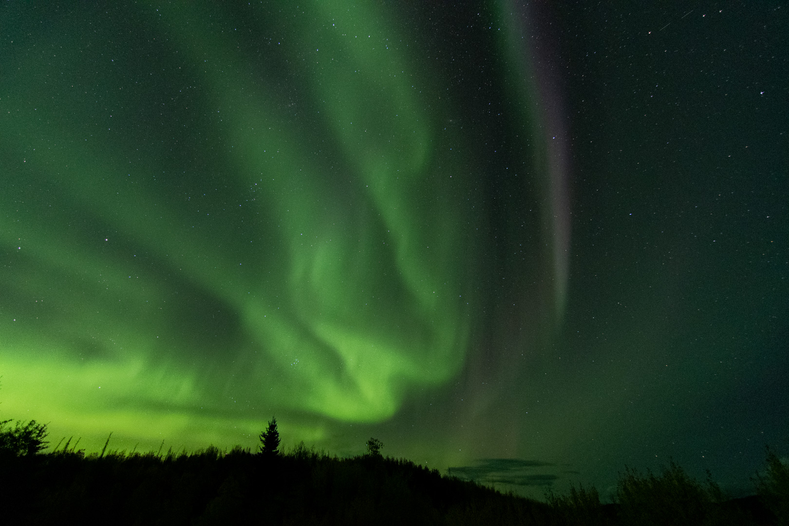
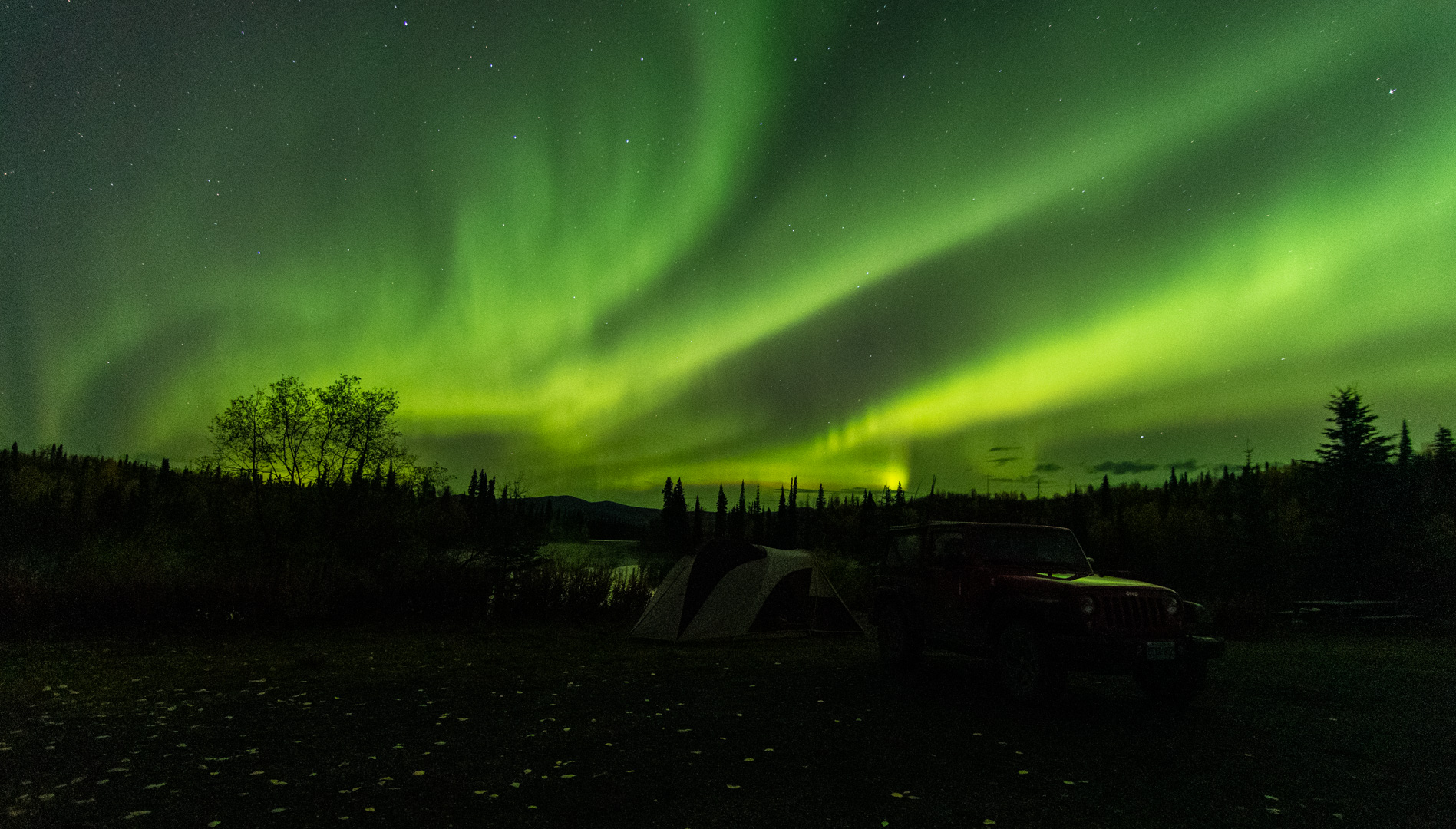
I wasn’t going to make it all the way back to Ross River in one day so I headed for a spot I had seen on the way in. There were two other guys there already. Fellow travelers with more experience than myself. We sat around the campfire that evening swapping stories. The one guy was staying up for the northern lights, so I joined him.

The lake was like glass. The lights were pretty tame at first…at least compared with my last experience. It was getting cold(it got down to -1 that night) and I was tired from my day. I had literally just said I was going to bed…
When the sky exploded.

They were everywhere. It was amazing. We were running around getting pictures.
I’ll admit, if I was by myself, I would have just gone to bed earlier and missed them. I’m not usually one that wants company when I’m camping, but God showed me again that it’s better with community.
The next morning, I said my goodbyes and headed back to Ross River.

Next up is another road, similar to the Canol, but not as crazy or epic. I had to drive the Campbell Highway there. Campbell is a decently remote highway in Yukon. The fun part? I drove a section that is 354km with no services and not really anything..and I just shrugged it off. I’ve driven the North Canol. What’s another 354km of remote highway…
I have to admit, while I look forward to coming home, I’m blown away by the fact that this trip just keeps surprising me!

What a journey you are on. You are an adventure seeking fellow. Keep safe!!
Hey, your Jeep is red again!! Thanks for sharing the gorgeous inroads!! My sis and hubby did off-roads in BC for a couple of years (i think) with a truck/camper combo. They’d have loved your trails!!
Thanks, Bev
Enjoyed the write-up. I did the North Canol in October 1975 on a 10-speed pedal bicycle. Lot of snow in the pass and on the NWT side. Then caught in blizzard going back to Ross River. Snow up to axle! RCMP came looking for me with a chopper but I said I was OK. Made it out and back to Edmonton in the snow. Epic trip for sure.